
What is recorded here
From the National Monuments Service (Archaeological Survey of Ireland) record CO089-028
Places near here
Photo credits
- Maker not stated on source page, tr.pinterest.com
- Maker not stated on source page, www.youtube.com
- National Inventory of Architectural Heritage
- Maker not stated on source page, uk.pinterest.com
- Maker not stated on source page, www.dreamstime.com
- Maker not stated on source page, www.flickr.com
- Maker not stated on source page, www.tripadvisor.com.ph
- Tim FitzGerald, Geograph · CC BY-SA 2.0
- Tim FitzGerald, Wikimedia Commons
 Fairy fort / earthen ringfort in BallycatooFairy fort / earthen ringfort · 1286 yd
Explorer Tom Fairy fort / earthen ringfort in Ballycatoo was recorded by Power in 1940, but now we don’t know where it is. It’s just…
 Enclosure in BallycatooEnclosure · 1289 yd
Explorer Tom Enclosure in Ballycatoo is only visible as a crop mark from above. It’s sub-rectangular and has a kink in the boundary…
 sign post1472 yd
Explorer Tom Sign post in Ballycatoo has been standing there since 1940, wearing its little harp like a proud badge. It’s all about…
 Holy well in Ballinvoher (imokilly By., Cloyne Par.)Holy well · 1692 yd
Explorer Tom Holy well in Ballinvoher goes by Tobar Cinn a Dhuidhe, which sounds fancy, but nobody knows exactly where it is…
 Fairy fort / earthen ringfort in Ballinvoher (imokilly By., Cloyne Par.)Fairy fort / earthen ringfort · 1720 yd
Explorer Tom Fairy fort / earthen ringfort in Ballinvoher is an arc of bank that locals call 'Fort Field', which sounds like a pub…
 Violet HillHouse · 1.1 mi
Explorer Tom Violet Hill in Carriglusky is wearing a slate coat like it’s going to a formal dinner that started in 1890. The porch…
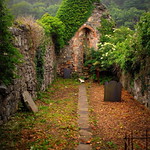 Church (in Ruins)Church · 1.2 mi
Explorer Tom Church in Churchtown in County Cork looks like it’s been rebuilt a few times because it had an identity crisis in the…
 CastleCastle, unclassified · 1.3 mi
Explorer Tom Castle in Ballycroneen West is where a poet fell into the ditch while trying to write a sonnet about the view, which…
Fairy fort / earthen ringfort in Ballycroneen WestFairy fort / earthen ringfort · 1.3 miExplorer Tom Fairy fort / earthen ringfort in Ballycroneen West holds a fake world record for being the most difficult place to…
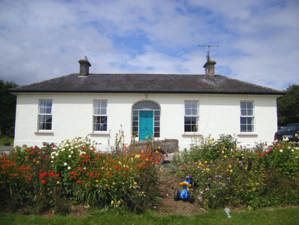 BallinvillaHunting/fishing lodge · 1.4 mi
Explorer Tom Ballinvilla in Ballinwillin is a U-plan hunting lodge from around eighteen-ten that looks like it’s hiding its true…
 Ballybrannigan BeachBeach / strand · 1.9 mi
Explorer Tom Ballybrannigan Beach is an East Cork strand that local dog walkers seem to have known about long before the rest of us…
 Inch Strand, WhitegateSurfing beach · 3.9 mi
Explorer Tom Inch Strand near Whitegate opens a sweep of sand where the waves have persuaded a surf school to set up shop. Fáilte…
More archaeology and monuments in County Cork · All of County Cork

What do you know about this place?Tap to add a comment or ask a question