What is recorded here
Marked but not named on 1842 OS 6-inch map; named on OS 1905 and 1935 maps. Well is at base of rock outcrop, with stream flowing in at S side and out at N side; very overgrown. Locally remembered that rounds were paid here and stone marked with sign of the cross. According to Byrne (1902, 88), Nicholas was brother to St Branait (13975) and St Cranith (13986). Well dedicated to St Cranith (14009) stood in walled garden of house (The Glen) c. 1 mile to NW; according to legend, it was moved to this location (and presumably renamed) when travelling man was insulted by woman of the house.
Marked but not named on 1842 OS 6-inch map; named on OS 1905 and 1935 maps. Well is at base of rock outcrop, with stream flowing in at S side and out at N side; very overgrown. Locally remembered that rounds were paid here and stone marked with sign of the cross. According to Byrne (1902, 88), Nicholas was brother to St Branait (13975) and St Cranith (13986). Well dedicated to St Cranith (14009) stood in walled…
From the National Monuments Service (Archaeological Survey of Ireland) record CO034-007001
The monument record does not grant public access. Check the route and ask the landowner before entering private land.
- What survives
- Recorded monument
Places near here
 farmyard complex122 ydMonanimy CastleCastle, tower house · 148 ydChurch (Site of)Church · 224 ydGrave YardGraveyard · 238 yd
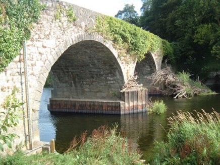 Killavullen BridgeBridge · 422 yd
 Killavullen CavesCave · 449 ydCave in BallymacmoyCave · 455 yd
 Scots Pine4.8 mi
 Doneraile CourtFoot bridge · 4.8 mi
 Ballyhooly CastleCastle · 4.9 mi
 Pedunculate Oak4.9 mi
 Doneraile CourtOrnamental canal/lake · 5.1 mi
Pictures: National Inventory of Architectural Heritage; Fattonyni, Wikimedia Commons · CC BY-SA 3.0; Hello, I am Bruce on Flickr, Wikimedia Commons · CC BY-SA 2.0; Jonathan Thacker, Geograph · CC BY-SA 2.0; Algirdas at Lithuanian Wikipedia, Wikimedia Commons · Public domain
More archaeology and monuments in County Cork · All of County Cork
What do you know about this place?