What is recorded here
On W side of limestone knoll, on S bank of Blackwater River (see plan Dowd 1997, 26, fig. 3.6); main complex of Killavullen Caves on E side of knoll (9806). Cave inspected by team from Dept of Archaeology UCC in 1997, who recovered 'recently disturbed' material from cave opening; this included 'some human remains' (ibid., 27, plate 3.3). It is not clear whether this cave was one of those excavated in 1934 (see 9806).
From the National Monuments Service (Archaeological Survey of Ireland) record CO034-005001
The monument record does not grant public access. Check the route and ask the landowner before entering private land.
- What survives
- Recorded monument
Places near here
 Killavullen CavesCave · 11 yd
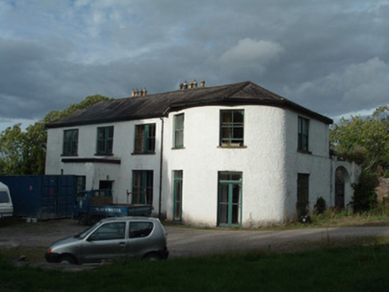 Ballymacmoy HouseCountry house · 42 yd
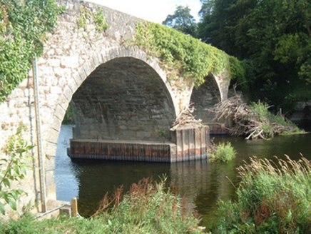 Killavullen BridgeBridge · 52 ydSt Nicholass WellHoly well · 455 ydMonanimy CastleCastle, tower house · 475 ydIndicatedEnclosure · 502 ydKillavuleen loopVisitor information · 605 yd
 Scots Pine4.9 mi
 Doneraile CourtFoot bridge · 4.9 mi
 Ballyhooly CastleCastle · 5.0 mi
 Pedunculate Oak5.1 mi
 Doneraile CourtOrnamental canal/lake · 5.2 mi
Pictures: Fattonyni, Wikimedia Commons · CC BY-SA 3.0; National Inventory of Architectural Heritage; Hello, I am Bruce on Flickr, Wikimedia Commons · CC BY-SA 2.0; Jonathan Thacker, Geograph · CC BY-SA 2.0; Algirdas at Lithuanian Wikipedia, Wikimedia Commons · Public domain
More caves in County Cork · All of County Cork
What do you know about this place?