
What is recorded here
Described in 1928 as 'This is marked on the Ordnance map as St. Fechin's Cross, but nothing now remains except a small rectangular platform of stones and clay. It is on the south side of the road to Oldcastle near the county boundary, 1 and a half miles N.E. of Fore' (Crawford 1928, 60-1, no. 12). Described in 1980 as 'Only the base of this cross survives. It is a low platform (dims. 2.2m NE-SW x 1.4m NW-SE; H 0.55m) of earth and grass covered stones built on a low natural rise or ridge. It is on the S side of a modern roadway just inside the fence. The field fence shown just S and SE of the cross on the 1914 ed. OS 6-inch map has been removed' (SMR file). The cross is only 150m W of the boundary with County Meath.
Compiled by: Caimin O'Brien
Date of upload: 23 June 2010
A local church or high cross; wider significance not recorded.
This remains an important historical record, but the official description says the monument is no longer visible or has been destroyed. The monument record does not grant public access. Check the route and ask the landowner before entering private land.
- What survives
- No visible remains or recorded as destroyed
Places near here
 kilnkiln · 51 yd
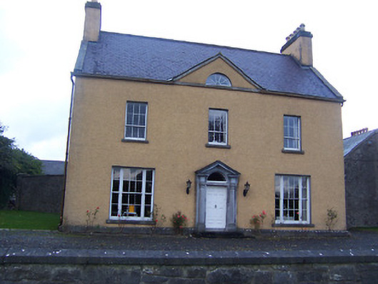 Sallymount Housefarm house · 483 yd
 Partially hachuredFairy fort / earthen ringfort · 1093 yd
 Enclosure in BallanyEnclosure · 1337 yd
 Ben of ForeMountain / peak · 1681 yd
 Fore AbbeyHeritage attraction · 1.1 mi
 MoatCastle, motte and bailey · 1.2 mi
 European ashEuropean ash · 1.2 mi
 St Feichin's MillHeritage attraction · 1.2 mi
 Christians Castle in ruinsCastle, unclassified · 1.3 mi
 European BeechEuropean Beech · 1.4 mi
 Seafin HillMountain / peak · 1.6 mi
Other information
Photo: Credit not shown in the picture search · Rights wording not checked; contact us if this picture should be removed