What is recorded here
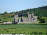
Orpen (1911-20 ii, 81) suggests that the motte was built by the elder Hugh de Lacy (d. 1186) but Graham (1980, 53) indicates that it may have been constructed closer to 1192. The castle of Fore was one of those confiscated from de Lacy by King John in 1210 but it was restored to him in 1215 (Sweetman 1875, No. 612). The motte was the centre of a large manor but after 1215 nothing is known of its history except the names of the individuals who owned it (Bradley et. al. 1985, 75). The site is situated on a ridge which affords commanding views on the south and west, but the view to the north and east is blocked by hills. The motte consists of an oval-plan conical mound rising from a basal width of 42m by 24m to a flat top measuring 26.2m by 16.8m. The bailey is square (18m x 18m) and lies south-west of the motte being seperated from it by a shallow ditch 3.5m wide. The motte and bailey is enclosed on the north, east, and south sides by a steep-sided ditch 7m wide with a counterscarp bank, 8-10m wide. A further short section of ditch, 2.2m wide, with a bank 11m wide, is present at the north-east end. On the south-east the front of the bailey is stone-faced and there is evidence for a causeway linking the bailey to the rest of the ridge. At the north-east end of the ridge there are grass covered earthworks for a three-roomed rectangular structure 17m in length, with a circular depression at the west end having a diameter of 6.7 m. South-east of the motte are a number of banks and ditches running up the side of Gallow's Hill. These may be the remains of field fences but their date and function is unclear (Bradley et. al. 1985, 75-6).
Orpen (1911-20 ii, 81) suggests that the motte was built by the elder Hugh de Lacy (d. 1186) but Graham (1980, 53) indicates that it may have been constructed closer to 1192. The castle of Fore was one of those confiscated from de Lacy by King John in 1210 but it was restored to him in 1215 (Sweetman 1875, No. 612). The motte was the centre of a large manor but after 1215 nothing is known of its history except…
From the National Monuments Service (Archaeological Survey of Ireland) record WM004-035014
The monument record does not grant public access. Check the route and ask the landowner before entering private land.
- What survives
- Recorded monument
Places near here
ToberfoolaghHoly well · 202 ydChristians Castle in ruinsCastle, unclassified · 370 yd Saint Feichin's Catholic ChurchChurch/chapel · 514 ydBen of ForeMountain / peak · 541 ydSouth East GateHeritage attraction · 546 ydEuropean ash668 ydFore AbbeyReligious house, Benedictine monks · 718 ydFont in ForeFont · 725 ydEuropean ash726 ydFore AbbeyHeritage attraction · 763 ydIndicatedCastle, motte and bailey · 781 ydCastle IslandIslet · 1.6 mi
 Saint Feichin's Catholic ChurchChurch/chapel · 514 yd
 Ben of ForeMountain / peak · 541 ydSouth East GateHeritage attraction · 546 yd
 European ash668 yd
 Fore AbbeyReligious house, Benedictine monks · 718 yd
 Font in ForeFont · 725 ydEuropean ash726 yd
_(page_1_crop).jpg/250px-Fore_Abbey,_County_Westmeath,_1835_(IA_jstor-30004138)_(page_1_crop).jpg "Photo: Illustrator not named; The Dublin Penny Journal (1835), public scan from Internet Archive and JSTOR, Wikimedia Commons · Public domain") Fore AbbeyHeritage attraction · 763 ydIndicatedCastle, motte and bailey · 781 ydCastle IslandIslet · 1.6 mi
Fore AbbeyHeritage attraction · 763 ydIndicatedCastle, motte and bailey · 781 ydCastle IslandIslet · 1.6 miPictures: Olliebailie, Wikimedia Commons · CC BY-SA 4.0; Oliver Dixon, Wikimedia Commons · CC BY-SA 2.0; Willow, Wikimedia Commons · CC BY 2.5; JohnArmagh, Wikimedia Commons · Public domain; Marathon, Wikimedia Commons · CC BY-SA 2.0; Illustrator not named; The Dublin Penny Journal (1835), public scan from Internet Archive and JSTOR, Wikimedia Commons · Public domain
More castles and forts in County Westmeath · All of County Westmeath
What do you know about this place?