What is recorded here
Located in a slight E-W valley at the S foothills of Slievecoiltia Hill, and just on the N side of a small NE-SW stream. A well is marked on the 1839 and 1940 eds of the OS 6-inch map and described as St. Bridget’s Well in gothic lettering on both. This is a slight sunken area (dims c. 5m x c. 4m), but there is no record of veneration, or any evidence of it. There is a church (WX039-009001-) c. 580m to the NW and the parish church of Ballybrazil (WX039-023001-) is c. 430m to the S.
Located in a slight E-W valley at the S foothills of Slievecoiltia Hill, and just on the N side of a small NE-SW stream. A well is marked on the 1839 and 1940 eds of the OS 6-inch map and described as St. Bridget’s Well in gothic lettering on both. This is a slight sunken area (dims c. 5m x c. 4m), but there is no record of veneration, or any evidence of it. There is a church (WX039-009001-) c. 580m to the NW and…
From the National Monuments Service (Archaeological Survey of Ireland) record WX039-012
The monument record does not grant public access. Check the route and ask the landowner before entering private land.
- What survives
- Recorded monument
Places near here
Photo credits
- Donald Hobern from Copenhagen, Denmark, Wikimedia Commons · CC BY 2.0
- A.-K. D., Wikimedia Commons · CC BY-SA 4.0
- National Inventory of Architectural Heritage
- Dr Charles Nelson, Wikimedia Commons · CC BY-SA 2.0
- Colin Park, Geograph · CC BY-SA 2.0
- Mike Searle, Geograph · CC BY-SA 2.0
- David Purchase, Wikimedia Commons · CC BY-SA 2.0
- Oliver Dixon, Geograph · CC BY-SA 2.0
 Silver Wattle263 ydArboretum MapVisitor information · 331 yd
 Church (in ruins)Church · 469 yd
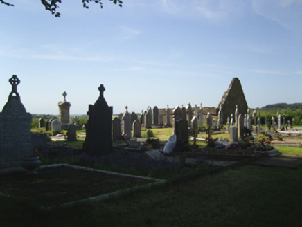 graveyard/cemetery479 ydBamboo CollectionVisitor information · 606 ydEcclesiastical enclosure in BallybrazilEcclesiastical enclosure · 638 yd
 The John F. Kennedy ArboretumForest · 936 ydNot indicatedFairy fort / earthen ringfort · 1305 yd
 Campile WWII Bombing MemorialMemorial · 1.7 mi
 Castle (in ruins)Castle, unclassified · 1.8 mi
 SlievecoiltiaMountain / peak · 2.0 mi
 Dunbrody CastleCastle · 2.1 mi
More archaeology and monuments in County Wexford · All of County Wexford
What do you know about this place?