What is recorded here
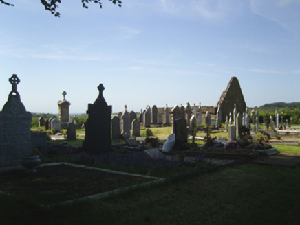
Situated at the bottom of a S-facing slope of Slievecoiltia Hill and at the headwaters of a small N-S stream. The church (WX039-009001-) and graveyard (WX039-009003-) are within a large enclosure (int. dims. 94m E-W; 86m N-S) defined by slight traces of a fosse (Wth c. 13m) NNW-E and a scarp SE-SW. The site of Crone Well (WX039-010----) is just outside the enclosure at SW.
From the National Monuments Service (Archaeological Survey of Ireland) record WX039-009003
The monument record does not grant public access. Check the route and ask the landowner before entering private land.
- What survives
- Recorded monument
Places near here
Photo credits
- Donald Hobern from Copenhagen, Denmark, Wikimedia Commons · CC BY 2.0
- Dr Charles Nelson, Wikimedia Commons · CC BY-SA 2.0
- A.-K. D., Wikimedia Commons · CC BY-SA 4.0
- National Inventory of Architectural Heritage
 Silver Wattle552 ydSt. Bridgets WellHoly well · 638 ydBamboo CollectionVisitor information · 665 ydArboretum MapVisitor information · 708 ydNot indicatedFairy fort / earthen ringfort · 751 yd
 The John F. Kennedy ArboretumForest · 990 yd
 Church (in ruins)Church · 1032 yd
 graveyard/cemetery1033 ydCastle (in ruins)Bawn · 1175 ydJohn F. Kennedy Arboretum MuseumMuseum · 1198 ydCastleCastle, tower house · 1214 ydGarden of RemembranceMemorial · 1.2 mi
More archaeology and monuments in County Wexford · All of County Wexford
What do you know about this place?