What is recorded here
Located towards the bottom of the SW-facing slope of Slievecoiltia Hill. This is a circular grass and scrub-covered area (diam. 38m NE-SW) that is overgrown at the N and slopes down steeply to the SW. It is defined by a low bank (Wth 4m; int. H 0.2m; ext. H 0.4m) NW-NE and a low scarp (H 0.8m at SW) elsewhere. There is an external fosse (Wth of top 8m; max. ext. D 1.2m) NW-NE which becomes a berm (Wth c. 13m) NE-S-NW defined by a scarp (H 0.3m at SW) SE-SW and a curved field bank SW-NW. There are traces of a further outer earthwork in a scarp S-SW (H 2m) 10m distant from the outer scarp, which may be a natural scarp down to a stream running off to the W. There is no identifiable entrance.
Located towards the bottom of the SW-facing slope of Slievecoiltia Hill. This is a circular grass and scrub-covered area (diam. 38m NE-SW) that is overgrown at the N and slopes down steeply to the SW. It is defined by a low bank (Wth 4m; int. H 0.2m; ext. H 0.4m) NW-NE and a low scarp (H 0.8m at SW) elsewhere. There is an external fosse (Wth of top 8m; max. ext. D 1.2m) NW-NE which becomes a berm (Wth c. 13m)…
From the National Monuments Service (Archaeological Survey of Ireland) record WX039-008
The monument record does not grant public access. Check the route and ask the landowner before entering private land.
- What survives
- Recorded monument
Places near here
Photo credits
- Dr Charles Nelson, Wikimedia Commons · CC BY-SA 2.0
- National Inventory of Architectural Heritage
- Donald Hobern from Copenhagen, Denmark, Wikimedia Commons · CC BY 2.0
IndicatedFairy fort / earthen ringfort · 272 ydEcclesiastical enclosure in BallybrazilEcclesiastical enclosure · 751 ydArboretum MapVisitor information · 854 ydBamboo CollectionVisitor information · 952 ydJohn F. Kennedy Arboretum MuseumMuseum · 969 yd The John F. Kennedy ArboretumForest · 1060 ydWhitechurch ChurchChurch/chapel · 1079 ydpost box1091 ydSilver Wattle1107 ydCastleCastle, tower house · 1142 ydThe Croppy GroveMemorial · 1737 ydGarden of RemembranceMemorial · 1740 yd
 The John F. Kennedy ArboretumForest · 1060 yd
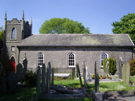 Whitechurch ChurchChurch/chapel · 1079 yd
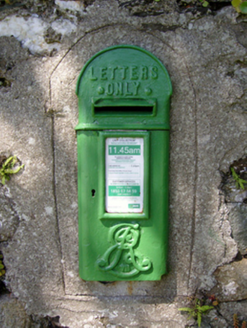 post box1091 yd
 Silver Wattle1107 ydCastleCastle, tower house · 1142 ydThe Croppy GroveMemorial · 1737 ydGarden of RemembranceMemorial · 1740 yd
More archaeology and monuments in County Wexford · All of County Wexford
What do you know about this place?