DDiscover AloneMapAbout

St. Bridgets Church, County Laois (LA019-014001-)

Church

What is recorded here

In gently undulating countryside. Church marked on the 1838 edition of the OS 6-inch map standing in the centre of St. Bridget's graveyard (LA019-014002-). Ballintubbert Church of Ireland Church may have been built on the site of or incorporated part of an earlier medieval church (Comerford 1883-6, vol. 3, 127). The…

Read the whole record
In gently undulating countryside. Church marked on the 1838 edition of the OS 6-inch map standing in the centre of St. Bridget's graveyard (LA019-014002-). Ballintubbert Church of Ireland Church may have been built on the site of or incorporated part of an earlier medieval church (Comerford 1883-6, vol. 3, 127). The medieval church of Ballintubbert is depicted on the 17th century Down Survey map of Ballyadams Barony. The terrier of the Down Survey parish of Fontstowne recorded that there was in 'Ballintubber and Moniscribban a slated House in repaire and an old ruined church'. The late 13th century ecclesiastical taxation of the Diocese of Leighlin lists the rectory of 'Fonston alias Ballintobber' which was valued at £10 2s (Comerford 1883-6, vol. 1, 239). No surface remains visible of this medieval church in the vicinity of the 19th century C of I church. However, located 16m to the E of the C of I church in the E quadrant of the graveyard are the low wall footings of a rectangular building (int. dims. 7.95m E-W; 5.5m N-S; wall T 1m) roughly aligned E-W which could be the partial remains of the medieval church of Ballintubbert that is indicated on the Down Survey map. The ivy-clad NE angle of this building survives is the only section that remains upstanding to a height of 1m above the present graveyard surface. The E wall survives upstanding for a length of 1.2m and the N wall for a distance of 0.55m. Uninscribed grave-markers in graveyard (LA019-014002-) and holy well (LA019-014003-) 25m to SE of St. Bridget's Church. Comerford recorded that the 'Protestant Church of Ballintubber occupies the site of the primitive parochial church; this is evidenced by the fact of Catholics being still interred in the burial ground (LA019-014002-) attached to it' (Comerford 1883-6, vol. 3, 127).

From the National Monuments Service (Archaeological Survey of Ireland) record LA019-014001

The monument record does not grant public access. Check the route and ask the landowner before entering private land.

Official monument number
LA019-014001-
What do you know about this place?Tap to add a comment or ask a question

What you write will be public.

Places near here

Photo credits
  • A.-K. D., Wikimedia Commons · CC BY-SA 4.0
  • Picture: laoisgaa.ie
  • National Inventory of Architectural Heritage
  • Algirdas at Lithuanian Wikipedia, Wikimedia Commons · Public domain
  • Graham Horn, Geograph · CC BY-SA 2.0
Holy well in BallintubbertHoly well · 15 yd

Explorer Tom Holy well in Ballintubbert would teach history by splashing you with water every time you mention the wrong century or…

Saint Brigid's Church (Ballyadams)Church/chapel · 39 yd

Explorer Tom Saint Brigid's Church (Ballyadams) is arguing with its lime trees about who has the better view. A poet was born here…

Dm PenderMemorial · 58 yd

Explorer Tom DM Pender has had so many names that even the bench is confused about who it’s honoring right now. It just sits there…

Ballintubbert HouseRectory/glebe/vicarage/curate's house · 154 yd

Explorer Tom Ballintubbert House in Ballintubbert, County Laois would get 'Here lies a rectory that never stopped dreaming' on its…
Tony Byrne Park, St Josephs GAAGAA ground · 623 ydmilestone/milepost1473 yd

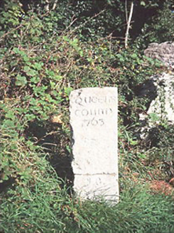
Explorer Tom Milestone or milepost in Kellyville would complain to the council about tourists leaning on it like it’s a bench. It’s…
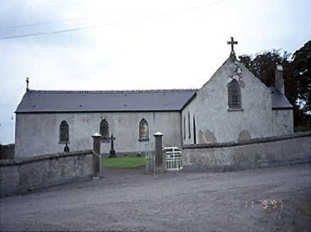
Saint Joseph's Catholic ChurchChurch/chapel · 1.4 mi

Explorer Tom Saint Joseph's Catholic Church in Ballyadams would be the uncle at a wedding who knows too much gossip. It’s on a…

Ballyadams Castle (in Ruins)Castle, tower house · 1.7 mi

Explorer Tom Ballyadams Castle has a prophecy that says it’ll be famous by 2050, but nobody believes it because it’s six storeys…

Ballyadams CastleCastle · 1.7 mi

Explorer Tom Ballyadams Castle nearly got sold off as a premium horse in one of its earlier incarnations, which is wild when you…
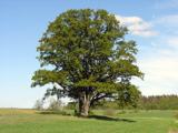
Pedunculate Oak1.7 mi

Explorer Tom Pedunculate Oak in County Laois made the builder think, ‘Yeah, I’ll just build right next to that giant.’ The oak…

Oughaval Wood MapVisitor information · 2.2 mi

Explorer Tom Oughaval Wood Map is cursed so that anyone who doesn't wave at the trees will get lost in a loop for three days…

CemeteryGraveyard · 2.5 mi

Explorer Tom Cemetery in Carricksallagh would post on social media: 'Just another day overlooking Stradbally, feeling very important…

More historic places in County Laois · All of County Laois

Add to this placeAdd a picture Add a detailed tip Add a story

Explore the map1,095,414 places to discover

Next place · or swipeHoly well in Ballintubbert