
Places near here
Photo credits
- National Inventory of Architectural Heritage
- Vicente Fernández Rioja, Wikimedia Commons · CC BY-SA 4.0
- Jean-Pol GRANDMONT, Wikimedia Commons · CC BY 3.0
- John Williams Writes, Wikimedia Commons · CC BY-SA 4.0
- Colin Park, Geograph · CC BY-SA 2.0
- A.-K. D., Wikimedia Commons · CC0
- A.-K. D., Wikimedia Commons · CC BY-SA 4.0
- MonikaLisa2, Wikimedia Commons · CC BY-SA 4.0
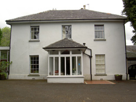 GreyfortHouse · 179 yd
Explorer Tom Greyfort in Raheen is flashing its slate chevron pattern like a cat showing off its tail to the whole village. The map makers clearly got drunk and drew it three streets over, which explains the confusion. Just admire that South Tipperary style from afar!
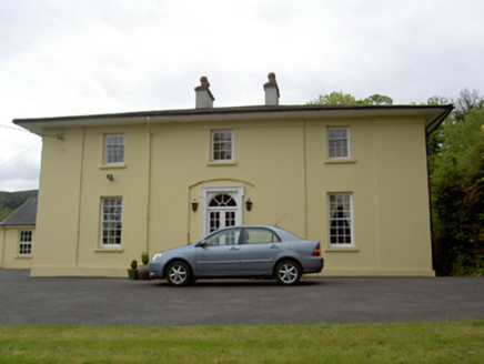 Parkminster Green ParkHouse · 229 yd
Explorer Tom Parkminster Green Park in Raheen thinks it is the coolest house on Coleville Road, which is a bold claim for a building with sliding sash windows. Its least favourite visitor is definitely anyone who calls its overhanging eaves just 'roof stuff'. Stand back and let the timber architrave do the talking, you lazy sod.
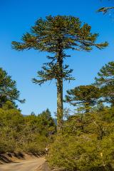 Monkey-puzzle304 yd
Explorer Tom Monkey-puzzle in County Tipperary thinks tourists from Dublin are all a bit too loud and not respectful enough of its spiky personality. It would love nothing more than to poke one gently to make them question their life choices. Count the crows, then count again.
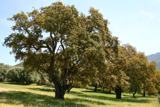 Cork oak306 yd
Explorer Tom Cork oak in County Tipperary sounds like a cello being played by someone who is really angry at their landlord during the quiet hours of the night. It’s got this thick, bumpy bark that looks like it’s been through centuries of arguments with the weather and won most of them. Pack a picnic and an excuse.
 Allen, Larkin and O'Brien MonumentMonument · 723 yd
Explorer Tom Allen, Larkin and O'Brien Monument is standing tall in Clonmel, probably writing its dating profile to attract serious historical figures only. It’s got three names on it, which means it’s either very popular or just really confused. Go before the tourists find out.
Little IslandIslet · 988 ydExplorer Tom Little Island has a secret it would only spill after three pints of stout, which involves a buried treasure that is actually just a very old boot with no sock. It’s been waiting for someone to care enough to dig it up and appreciate its humble origins as a historical artifact of footwear. Bring biscuits, every good story needs biscuits to go with the talk.
 Frank PattersonMemorial · 1067 yd
Explorer Tom Frank Patterson was Ireland’s Golden Tenor, which sounds like he sang while covered in gold paint. Two lads bet a fiver that he could hit high C with his eyes closed. Bring a flask of something warm and a story to swap.
Tipperary Museum of Hidden HistoryMuseum · 1079 ydExplorer Tom Tipperary Museum of Hidden History thinks the rabbits are the ones hiding the real secrets, not the people. It’s all about things nobody talks about, which makes it the most interesting place in the county. Pretend you're a lost aristocrat, nobody will check your credentials here.
 Charles BianconiMemorial · 1119 yd
Explorer Tom Charles Bianconi in County Tipperary has been feuding with the rain since the plaque was put up, which is annoying because he’s just a guy who started a business. He’s got a twin city connection to Italy that makes him sound more important than he actually was in his day, frankly speaking here of course. Grand place for a sulk or a snog, your call.
 Merchant's HouseVisitor information · 1324 yd
Explorer Tom Merchant's House in County Tipperary was saved by a hero nobody remembers, probably because he got paid in pints and forgot his own name by the time he left. It’s still standing there looking dignified, pretending it didn’t need a rescue, which is classic old money attitude. Ideal spot for a dramatic phone call.
 Streches IslandIsland · 1326 yd
Explorer Tom Streches Island started because two lads made a bet in the pub about whether they could name a rock before the next pint was finished. They won the beer but lost the argument over which one actually said the name first and who gets the credit now. Linger, it's not going anywhere and neither should you.
 Graveyard1467 yd
Explorer Tom Graveyard in Burgagery-Lands West is hosting a royal visit that nobody can disprove. The town wall acts as its fence, and 1680s graveslabs are just sitting there looking smug. Ideal spot for a dramatic phone call.
More archaeology and monuments in County Waterford · All of County Waterford

What do you know about this place?Tap to add a comment or ask a question