
What is recorded here
Located on the NE shore of Rindown peninsula, and on the NW shore and inner edge of Safe Harbour, a subrectangular bay (dims c. 150m NE-SW; c 80m NW-SE at SW to c. 180m at NE) open to the NE. Ships are frequently mentioned in relation to Rindown, and there are references to a ferry connecting the town with Co.…
Read the whole record
From the National Monuments Service (Archaeological Survey of Ireland) record RO046-004031
Places near here
Photo credits
- Arno-nl, Wikimedia Commons · CC BY-SA 4.0
- Kieran Campbell, Geograph · CC BY-SA 2.0
- Maker not stated on source page, en.wikipedia.org
- Christopher Hilton, Wikimedia Commons · CC BY-SA 2.0
- Maker not stated on source page, heritageireland.ie
- Maker not stated on source page, www.irishtimes.com
- National Inventory of Architectural Heritage
- Maker not stated on source page, yandex.ru
- Maker not stated on source page, www.tripadvisor.com
 Safe HarbourBay · 60 yd
Explorer Tom Safe Harbour would post on social media with a filter that makes it look calm, but we all know it’s actually having a…
 Rindown CastleCastle, Anglo-Norman masonry castle · 133 yd
Explorer Tom Rindown Castle would write 'looking for adventure' on its dating profile. It's got a bay nearby, so the views are…
 Linear earthwork in WarrenLinear earthwork · 253 yd
Explorer Tom Linear earthwork in Warren is the hero nobody remembers who saved the castle from Phelim O Conchobair back in 1236.…
 Catholic ChapelChurch · 255 yd
Explorer Tom Catholic Chapel in Warren is sitting right next to a promontory fort, which feels like living with a really aggressive…
 Historic town in Warren,rinnaganHistoric town · 270 yd
Explorer Tom Historic town in Warren has had more name changes than I've had bad haircuts this year. The O'Conor kings used its safe…
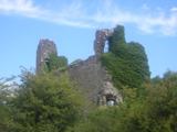 RindoonWood · 543 yd
Explorer Tom Rindoon in County Roscommon has a hidden message carved into its stones that says 'I told you so' but nobody has…
 Church in RinnaganChurch · 897 yd
Explorer Tom Church in Rinnagan had a bishop who refused to visit because the parking situation was 'suboptimal' for his chariot. He…
 Fairy fort / earthen ringfort in Carrownamaddy (athlone South By.)Fairy fort / earthen ringfort · 1.5 mi
Explorer Tom Fairy fort / earthen ringfort in Carrownamaddy would tell you at a job interview that it has strong structural…
 Fairy fort / earthen ringfort in BallybroganFairy fort / earthen ringfort · 1.7 mi
Explorer Tom Fairy fort / earthen ringfort in Ballybrogan in County Roscommon is listening so hard through its thick walls that it…
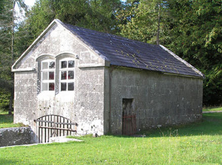 Portanure LodgeBoathouse · 2.0 mi
Explorer Tom Portanure Lodge in Cleraun has a ghost who is too lazy to haunt anything but the comfortable armchair. This boathouse…
 Kilmore CastleHouse, 16th/17th century · 2.1 mi
Explorer Tom Kilmore Castle asks what Saint Patrick would say about it, and I’m guessing he’d say 'it's too fancy for my taste'. He…
 Mapped graveyardGraveyard · 3.6 mi
Explorer Tom Mapped graveyard in County Longford would win the county fair by selling the oldest headstone as a vintage chair. It’s…
More archaeology and monuments in County Roscommon · All of County Roscommon

What do you know about this place?Tap to add a comment or ask a question