
Places near here
Photo credits
- National Inventory of Architectural Heritage
- Maker named on the Wikimedia Commons picture page · CC BY-SA 3.0
- Yosemite, Wikimedia Commons · CC BY-SA 3.0
- Sheila1988, Wikimedia Commons · CC BY-SA 4.0
 farm house1497 ydBawn in Newcastle (bargy By.)Bawn · 1590 yd
Explorer Tom Bawn in Newcastle ended up in the wrong place because someone dropped a brick and nobody bothered to pick it up, so now it’s just a fragment pretending to be significant. It runs north from the tower house like it has somewhere better to be, but really it’s just lost and confused about its purpose. Take a mate and argue about what it was for.
St. Catherines WellHoly well · 1754 ydExplorer Tom St. Catherines Well in Gorteenminoge Lower is hidden at ground level, probably because the map makers got confused and put it in the wrong townland. It’s sitting by a small stream, wondering why nobody can find it when it’s right there under their noses. Go at sunset and thank me later.
 Saint Catherine's Catholic ChurchChurch/chapel · 1.2 mi
Explorer Tom Saint Catherine's Catholic Church in Murntown Lower was rebuilt after someone offered up an acre of land. A fiddler once played there all night, which is either holy or terrifying depending on your tolerance for violins. Listen from the gate and see if you can hear the lingering echoes of that tune.
St. Mannans WellHoly well · 1.4 miExplorer Tom St. Mannans Well in Woodtown is named after Moininne, but the mapmakers clearly got the vowels all tangled up in knots. It’s like trying to explain a joke to a drunk uncle who keeps interrupting with his own stories. Best visited with a curious kid and no timetable.
Castle (Site of)Castle, unclassified · 1.5 miExplorer Tom Castle in Ballycappoge nearly got famous when a charter mentioned it in 1178, but then history forgot about it like a bad dream you can’t quite remember. It’s on level land, which is great for rolling around and pretending you’re a medieval soldier having a nap. Find the wonkiest bit of wall and send it to your group chat; they’ll love the drama.
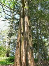 Dawn Redwood1.9 mi
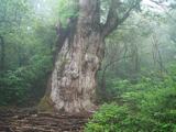 Japanese cedar1.9 miJohnstown Castle Visitor CentreHeritage attraction · 2.0 mi
 Irish Agricultural MuseumMuseum · 2.0 miSkeater RockMountain / peak · 2.1 miCarrickatinna RockMountain / peak · 2.3 mi
More historic places in County Wexford · All of County Wexford

What do you know about this place?Tap to add a comment or ask a question