What is recorded here
From the National Monuments Service (Archaeological Survey of Ireland) record WX042-022
The monument record does not grant public access. Check the route and ask the landowner before entering private land.
- What survives
- Recorded monument
Places near here
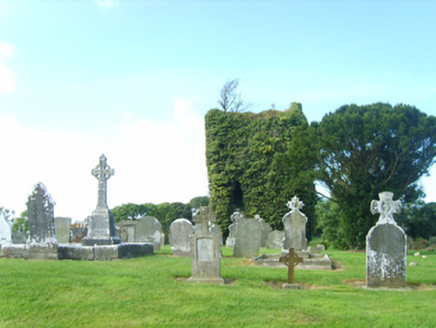 graveyard/cemetery358 yd
 farm house376 yd
 Font in BallyconnickFont · 2.1 mi
 Forth MountainMountain / peak · 2.7 mi
 Dawn Redwood3.0 mi
 Japanese cedar3.1 mi
 Johnstown CastleCastle · 3.2 mi
 Taghmon CastleCastle · 4.5 mi
 Cull IslandIsland · 5.7 mi
 Coolhull CastleHouse, fortified house · 6.2 mi
 Windmill7.1 mi
 Cullenstown StrandBeach / strand · 7.5 mi
Pictures: National Inventory of Architectural Heritage; Andreas F. Borchert, Wikimedia Commons · CC BY-SA 4.0; Richard Webb, Geograph · CC BY-SA 2.0; Maker named on the Wikimedia Commons picture page · CC BY-SA 3.0; Yosemite, Wikimedia Commons · CC BY-SA 3.0; David Hawgood, Wikimedia Commons · CC BY-SA 2.0; Jonathan Thacker, Geograph · CC BY-SA 2.0; kevin higgins, Geograph · CC BY-SA 2.0; Pam Brophy, Wikimedia Commons · CC BY-SA 2.0; Oliver Dixon, Geograph · CC BY-SA 2.0
More archaeology and monuments in County Wexford · All of County Wexford
What do you know about this place?