What is recorded here
On E Side of Brown Island, in estuary to N of Great Island. Heavily overgrown, extent of midden not determined; mainly oyster shells visible. Schlichting (1973, 16-17) records 'a bank piled along edge of boulder clay knoll' measuring '130 feet long' and '2 to 4 feet thick'; midden contains majority of oyster shells as well as fragments of mussels, periwinkle, land snail, cockle and fire shattered stones. A radio-carbon determination of 300 +/- 50 bp (calibrated date range 1470 – 1690 AD) was recovered from oyster shell at this midden (Laboratory: Beta 161650) (Milner & Woodman 2007, 103). In this instance the entry has been revised and updated in the light of recent research. Revised by: Paul Walsh
Date of revision: 25 June 2012
On E Side of Brown Island, in estuary to N of Great Island. Heavily overgrown, extent of midden not determined; mainly oyster shells visible. Schlichting (1973, 16-17) records 'a bank piled along edge of boulder clay knoll' measuring '130 feet long' and '2 to 4 feet thick'; midden contains majority of oyster shells as well as fragments of mussels, periwinkle, land snail, cockle and fire shattered stones. A…
From the National Monuments Service (Archaeological Survey of Ireland) record CO076-013
The monument record does not grant public access. Check the route and ask the landowner before entering private land.
- What survives
- Recorded monument
Places near here
Photo credits
- National Inventory of Architectural Heritage
- AfroBrazilian, Wikimedia Commons · CC BY-SA 4.0
- Krzysztof Ziarnek, Kenraiz, Wikimedia Commons · CC BY-SA 4.0
- Hywel Williams, Geograph · CC BY-SA 2.0
- Elena Tatiana Chis, Wikimedia Commons · CC BY-SA 4.0
- The Speckled Bird, Wikimedia Commons · CC BY-SA 4.0
- Ian S, Geograph · CC BY-SA 2.0
 quay/wharf557 yd
 gate lodge995 ydShell MoundMidden · 1030 ydBarrowBarrow, mound barrow · 1117 yd
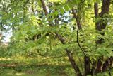 Japanese walnut1.1 mi
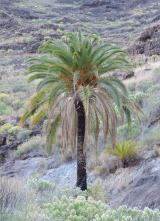 Canary Island date palm1.1 miSite of old schoolHeritage attraction · 1.2 mi
 Ballyannan Castle (in Ruins)House, fortified house · 1.5 miRossmore BayBay · 1.7 mi
 Barrys Court Castle, Tower(s)Castle, tower house · 2.1 mi
 Barryscourt CastleCastle · 2.1 mi
 CuskinnyBeach / strand · 2.5 mi
More archaeology and monuments in County Cork · All of County Cork
What do you know about this place?