What is recorded here
In tillage atop Bagwells Hill. No visible surface trace. One of four tumuli (CO087-085---; CO087-092---; CO075-044---) referred to by Coleman (1894, 35) on the Great Island;....'called the Moate, hence the hill is named Cnocan Móta'. Power (1923, 200) refers to it as 'The Moat'.
From the National Monuments Service (Archaeological Survey of Ireland) record CO076-100
The monument record does not grant public access. Check the route and ask the landowner before entering private land.
- What survives
- Recorded monument
Places near here
Photo credits
- National Inventory of Architectural Heritage
- Krzysztof Ziarnek, Kenraiz, Wikimedia Commons · CC BY-SA 4.0
- AfroBrazilian, Wikimedia Commons · CC BY-SA 4.0
- Hywel Williams, Geograph · CC BY-SA 2.0
 Waterloo TowerMonument · 359 yd
 East GroveGate lodge · 366 ydBagwells TowerCastle · 407 yd
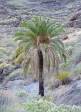 Canary Island date palm1029 yd
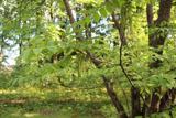 Japanese walnut1114 ydShell MoundMidden · 1117 ydMass-rock in WalterstownMass-rock · 1265 ydSite of old schoolHeritage attraction · 1567 ydWater PumpHeritage attraction · 1.2 miGarrankinnefeake GraveyardRuins · 1.4 mi
 Ballyannan Castle (in Ruins)House, fortified house · 1.5 miGlenmore StrandBeach / strand · 1.7 mi
More archaeology and monuments in County Cork · All of County Cork
What do you know about this place?