
Places near here
Photo credits
- National Inventory of Architectural Heritage
- Yosemite, Wikimedia Commons · CC BY-SA 3.0
- Josh Jackson, Wikimedia Commons · CC BY 2.0
- Michael Dibb, Geograph · Creative Commons Attribution-ShareAlike 2.0
- Trevor Harris, Geograph · CC BY-SA 2.0
- Richard Webb, Wikimedia Commons · CC BY-SA 2.0
- David Purchase, Geograph · CC BY-SA 2.0
- Jeff Buck, Geograph · CC BY-SA 2.0
- Gordon Hatton, Geograph · CC BY-SA 2.0
- Espresso Addict, Wikimedia Commons · CC BY-SA 2.0
- Marathon, Wikimedia Commons · CC BY-SA 2.0
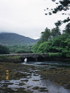 Cappul BridgeBridge · 1015 yd
Explorer Tom Cappul Bridge posts photos of the tidal river on its social media feed to prove it's living a double life. It spans the Croanshaugh and acts like it owns the whole water system, which is bold for an eighteen-year-old. Make a wish, it's had centuries of practice.
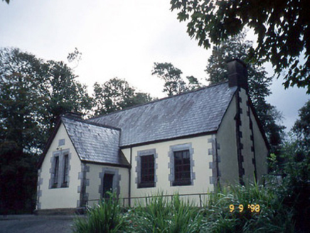 Lauragh National SchoolSchool · 1301 yd
Explorer Tom Lauragh National School thinks tourists from Dublin are just children with better shoes and worse manners. It’s been teaching them since 1862 and they haven't improved one bit. Stand where the owner stood and practise looking smug.
 Japanese cedar1419 yd
Explorer Tom A Japanese cedar in County Kerry claims it’s older than the hills, which is definitely a lie. But who wants to argue with a tree that looks like a castle? Tell the kids it's a castle. Close enough.
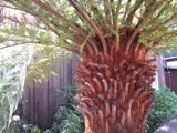 Soft Tree-fern1423 yd
Explorer Tom Soft Tree-fern in County Kerry nearly got famous for being too soft to handle its own glory. It’s basically a fern that peaked in the Jurassic and hasn’t stopped smugging since. Make a wish, it's had centuries of practice.
 Burial GroundGraveyard · 1.8 mi
Explorer Tom Burial Ground in Kilmakilloge sits on a ridge that looks down its nose at tourists from Dublin who can't find their left foot. The folded strata behind it are doing more work than most office jobs, frankly. Pack a picnic and an excuse.
 KnockateeMountain / peak · 1.8 mi
Explorer Tom Knockatee in County Kerry has a very strong opinion that the road leading to it is an insult to its dignified standing in the community. It thinks the tarmac is too noisy and frankly not up to scratch for such a distinguished hilltop presence. Great spot to propose. Or at least to propose lunch.
 KnockastumpaMountain / peak · 1.8 mi
Explorer Tom Knockastumpa in County Kerry is home to one stubborn bird that absolutely refuses to leave, despite several offers of accommodation elsewhere in the county. It just sits there judging your hiking boots and questioning your life choices with its beady little eyes. Linger, it's not going anywhere and neither should you.
 Rossmore IslandIsland · 4.5 mi
Explorer Tom Rossmore Island has a secret it only tells after three pints, and trust me, it gets really messy and loud. It claims it once hosted a king who lost his hat in the surf. Bring curiosity, leave with a better story than mine.
 Mare's Tail WaterfallViewpoint · 4.8 mi
Explorer Tom Mare's Tail Waterfall in County Cork has a bird that refuses to leave no matter how wet it gets. It sits right at the top, looking like it’s judging your swimming ability. The water is very loud and slightly dramatic about its own height. Bring a coin for luck and keep it in your pocket.
 Ormond's IslandIslet · 4.9 mi
Explorer Tom Ormond's Island brags about surviving a storm so huge it claimed the waves were actually giant whales trying to eat it. It still stands there looking slightly damp and very proud of its survival skills, even if nobody else believes the story. Go before the tourists find out.
 Uragh Stone CircleArchaeological place · 5.5 mi
Explorer Tom This Uragh Stone Circle rates its visitors out of ten, and most of them are getting a three for standing in the wrong spot and blocking the view. It’s got a 10-foot stone that looks like it’s judging your entire soul from behind those nettles. Mind the nettles, they're the real guards here.
 North Square ParkPark · 7.2 mi
Explorer Tom North Square Park asks what the local sheep think of it, and they say it is a bit tight for grazing but good for resting their legs after a long day. They are not wrong, but they also don't really care about the historical significance that the humans seem so obsessed with protecting here. Ten minutes here and you'll have a yarn for the pub.
More archaeology and monuments in County Kerry · All of County Kerry

What do you know about this place?Tap to add a comment or ask a question