What is recorded here
In mountain pasture, at the foot of a terrace, on the NE slope of Knockbrack Mountain. A circular area (15.85m E-W; 14.7m N-S) defined by a drystone wall (T c. 0.8m; H 1.1m at S). The wall has partly collapsed in places; much of the external lower course comprises large stone slabs placed longitudinally and end-on. The interior is level. Indicated on the 1846 OS 6-inch map as a square enclosure (dims. c. 8m) and on the 1895 OS 6-inch map as a roughly circular enclosure (diam. c. 16m). There is a relict field system (KE094-019001-) in the area surrounding the enclosure. Volume I: South-West Kerry' (Dublin: Stationery Office, 2009).
In mountain pasture, at the foot of a terrace, on the NE slope of Knockbrack Mountain. A circular area (15.85m E-W; 14.7m N-S) defined by a drystone wall (T c. 0.8m; H 1.1m at S). The wall has partly collapsed in places; much of the external lower course comprises large stone slabs placed longitudinally and end-on. The interior is level. Indicated on the 1846 OS 6-inch map as a square enclosure (dims. c. 8m) and…
From the National Monuments Service (Archaeological Survey of Ireland) record KE094-019
The monument record does not grant public access. Check the route and ask the landowner before entering private land.
- What survives
- Recorded monument
Places near here
Photo credits
- Mike Searle, Wikimedia Commons · CC BY-SA 2.0
- National Inventory of Architectural Heritage
- Sitomon, Wikimedia Commons · CC BY-SA 2.0
- Roman van der Krogt, Geograph · CC BY-SA 2.0
- Graham Horn, Geograph · CC BY-SA 2.0
- Colin Park, Geograph · CC BY-SA 2.0
- P L Chadwick, Geograph · CC BY-SA 2.0
- P L Chadwick, Wikimedia Commons · CC BY-SA 2.0
- N Chadwick, Geograph · Creative Commons Attribution-ShareAlike 2.0
- dalvenjah on Flickr, Wikimedia Commons · CC BY-SA 2.0
Sheep FoldEnclosure · 423 yd Battle of CallannBattle · 1.2 miBattle of CallannBattlefield · 1.2 miArdtully Old BridgeBridge · 1.4 miEuropean Yew1.4 miArdtully HouseCountry house · 1.5 miBird HillMountain / peak · 1.9 miKnocknamanaghMountain / peak · 2.8 miBonane Heritage ParkMuseum · 4.0 miCrannogHeritage attraction · 4.2 miGraveyard4.5 miMonterey Pine4.9 mi
 Battle of CallannBattle · 1.2 miBattle of CallannBattlefield · 1.2 mi
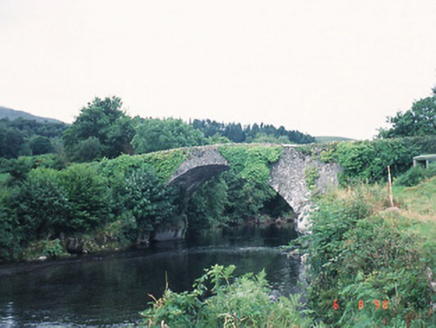 Ardtully Old BridgeBridge · 1.4 mi
 European Yew1.4 mi
 Ardtully HouseCountry house · 1.5 mi
 Bird HillMountain / peak · 1.9 mi
 KnocknamanaghMountain / peak · 2.8 mi
 Bonane Heritage ParkMuseum · 4.0 mi
,_near_Kenmare,_Co._Kerry_(geograph_5908221).jpg/250px-Bonane_Heritage_Park_-_reconstructed_crannog_(2),_near_Kenmare,_Co._Kerry_(geograph_5908221).jpg "Photo: P L Chadwick, Wikimedia Commons · CC BY-SA 2.0") CrannogHeritage attraction · 4.2 mi
CrannogHeritage attraction · 4.2 mi Graveyard4.5 mi
 Monterey Pine4.9 mi
More archaeology and monuments in County Kerry · All of County Kerry
What do you know about this place?