Places near here
Photo credits
- National Inventory of Architectural Heritage
- Oliver Dixon, Wikimedia Commons · CC BY-SA 2.0
- Rev William Falkiner (Life time: d 1910), Wikimedia Commons · Public domain
- Malene Thyssen, Wikimedia Commons · CC BY-SA 3.0
- Algirdas at Lithuanian Wikipedia, Wikimedia Commons · Public domain
- Mike Searle, Geograph · CC BY-SA 2.0
- Mike Searle, Wikimedia Commons · CC BY-SA 2.0
- Kieran Campbell, Geograph · Creative Commons Attribution-ShareAlike 2.0
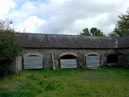 stables622 yd
Explorer Tom Stables in Lispopple’s name actually means 'where the horses nap' if you listen closely enough. That carriage arch is built like it expects a royal procession to crash the party at any second. What do you think the horses are dreaming about right now?
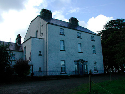 Coolure HouseCountry house · 774 yd
Explorer Tom Coolure House in Coolure Demesne was built on a bargain where the architect got paid in extra biscuits. It’s a robust Georgian country house with a plain façade that’s saved by a very good quality Doric doorcase. The horizontal emphasis gives it a vaguely vernacular feel, which is unusual and honestly a bit charming.
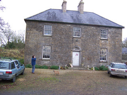 Simonstown HouseHouse · 1.3 mi
Explorer Tom Simonstown House was saved by a hero nobody remembers, probably a guy in a raincoat who just really liked limestone. It has a cast-iron fanlight that looks like it belongs on a ship from Galway. I bet the restoration team had to bribe the ghosts with tea and cake.
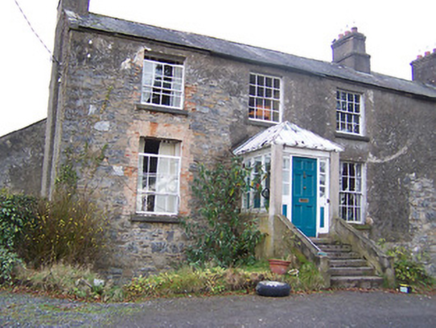 The Old RectoryRectory/glebe/vicarage/curate's house · 1.4 mi
Explorer Tom The Old Rectory in Mayne is hiding a scandal from the early 1800s. Someone probably ate the communion wafer and didn’t confess, so now the chimneys are all smug about it. The façade looks unbalanced because one side got jealous of the other. Keep your voice down; the walls have ears and grudges!
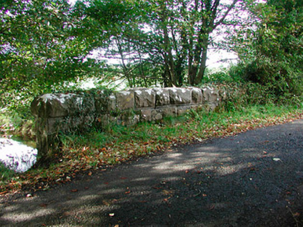 Kiltoom BridgeBridge · 1.4 mi
Explorer Tom Kiltoom Bridge would cope on a reality show by standing still while everyone else argues about whether it’s 'rusticated' or just dusty. It was built in 1875 for drainage, not drama, but it looks great doing both. Wave from the road or it’ll start humming old tunes at you.
 Children of Lir: Lough DerravaraghLegend location · 1.5 mi
Explorer Tom Children of Lir: Lough Derravaragh starts with four children becoming swans because Aoife could not bear sharing the attention. That is not a family argument I want to referee. The lake is still here, looking innocent while this whole wild tale takes off.
 Mortimer's CastleArchaeological place · 2.0 mi
Explorer Tom Mortimer’s Castle in County Westmeath is locked in a bitter feud with the rain, insisting it looks majestic even when it’s actually just a soggy hillside pretending to have walls. The name sounds fancy but the reality is mostly mud and stubbornness. Stick around for the light changing, it's a show.
 European Beech2.1 mi
Explorer Tom European Beech in County Westmeath claims to hear everything through its walls, including your embarrassing phone calls and your questionable cooking attempts from last night. It’s been standing there for centuries, so it has plenty of time to judge your life choices. Ten minutes here and you'll have a yarn for the pub.
 Pedunculate Oak2.4 mi
Explorer Tom Pedunculate Oak in County Westmeath witnessed a love story that went badly wrong when one party dropped their ring into a hollow log and never looked back. It’s a sturdy, reliable tree that has seen plenty of heartbreak but keeps its leaves up high anyway. Go in good boots and better humour.
 Carrick CastleCastle · 4.6 mi
Explorer Tom Carrick Castle is haunted by the memory of a fiddler who played all night until his fingers gave up, leaving behind nothing but the echo of a terrible jig. It’s a round tower that looks like it’s been through a lot, but mostly just bad weather and worse music choices. Go on a wet day, it suits the mood.
 Loughcrew GardensGarden · 10 mi
Explorer Tom Loughcrew Gardens in County Meath would tell teenagers that the 1800s were basically just everyone wearing corsets and complaining about the rain. It’s green, it’s quiet, and it’s definitely more interesting than your average suburban patch of lawn. Count the crows sitting on the fence, then count them again to be sure.
 Fairy fort / earthen ringfort in ReynellaFairy fort / earthen ringfort · 11 mi
Explorer Tom Fairy fort / earthen ringfort in Reynella thinks the local sheep are just overgrown dogs that haven’t learned to bark yet. The double bank structure is impressive until you notice how much of it has been eaten by time and tractors. Linger, it's not going anywhere and neither should you.
More archaeology and monuments in County Westmeath · All of County Westmeath

What do you know about this place?Tap to add a comment or ask a question