What is recorded here
On the headland overlooking Bunmahon Bay. In grassland, though the area had been exploited in the later 19th century for copper mining. Identified on lidar (Simon Dowling, 29 December 2016) as a settlement area (dims. c. 290m NE-SW c. 90m NNW-SSE) consisting of parallel burgage plots (avg. dims. L c. 90m; Wth c. 30m). Templeyrick medieval church (WA024-070----) is located c. 100m to the NE of the eastern end of the visible settlement. According to the Civil Survey (1654-6), in 1640 the proprietor was James Butler, Earl of Ormond, and in parish of 'Ballylanhen' it states that the 'Cheiffest place was Temple Ibrack, and had a Mannor and Royaltyes, the fishing of the Sea and River Mahin and the benefit of a Courte leete once a yeare' (Simington 1942, vol. 6, 118). This would appear to be the medieval settlement of Templeyrick. The manor house (WA024-093----) is currently unlocated.
On the headland overlooking Bunmahon Bay. In grassland, though the area had been exploited in the later 19th century for copper mining. Identified on lidar (Simon Dowling, 29 December 2016) as a settlement area (dims. c. 290m NE-SW c. 90m NNW-SSE) consisting of parallel burgage plots (avg. dims. L c. 90m; Wth c. 30m). Templeyrick medieval church (WA024-070----) is located c. 100m to the NE of the eastern end of…
From the National Monuments Service (Archaeological Survey of Ireland) record WA024-093001
The monument record does not grant public access. Check the route and ask the landowner before entering private land.
- What survives
- Recorded monument
Places near here
Photo credits
- National Inventory of Architectural Heritage
- A.-K. D., Wikimedia Commons · CC BY-SA 4.0
- Jonathan Thacker, Geograph · CC BY-SA 2.0
- Veekrokki, Wikimedia Commons · Public domain
- ethics girl, Geograph · CC BY-SA 2.0
- Colin Park, Geograph · CC BY-SA 2.0
- Philip Halling, Geograph · CC BY-SA 2.0
- Philip Halling, Wikimedia Commons · CC BY-SA 2.0
- John M, Geograph · CC BY-SA 2.0
- Alexander Redfern, Wikimedia Commons · CC BY-SA 4.0
Trá na mBóVisitor information · 231 yd Roseville HouseHouse · 434 ydDairy CottageHouse · 569 ydSlippery IslandPromontory fort, coastal · 757 ydBunmahon StrandBeach / strand · 814 ydCopper CoastCoastal geological landscape · 1164 ydBallydowane CoveBeach / strand · 1.2 miBoatstrand BeachBeach / strand · 3.2 miLime KilnVisitor information · 4.5 miDunhill CastleCastle · 5.0 miCastle (in ruins)Castle, tower house · 5.0 miBallinageeragh DolmenArchaeological place · 5.1 mi
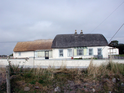 Roseville HouseHouse · 434 yd
 Dairy CottageHouse · 569 ydSlippery IslandPromontory fort, coastal · 757 yd
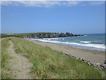 Bunmahon StrandBeach / strand · 814 yd
 Copper CoastCoastal geological landscape · 1164 yd
 Ballydowane CoveBeach / strand · 1.2 mi
 Boatstrand BeachBeach / strand · 3.2 mi
 Lime KilnVisitor information · 4.5 mi
 Dunhill CastleCastle · 5.0 mi
 Castle (in ruins)Castle, tower house · 5.0 mi
 Ballinageeragh DolmenArchaeological place · 5.1 mi
More archaeology and monuments in County Waterford · All of County Waterford
What do you know about this place?