What is recorded here
The Hearth Money Rolls for County Dublin (1664) list 10 houses with hearths in Glasnevin. In 1667 the householders increased to 24 and three houses were rated for 2 hearths and an oven and three for 2 hearths each (Ball 1920, 124-147). The farms associated with these houses are shown on a map based on information recorded in 1640 by Richard Francis.
From the National Monuments Service (Archaeological Survey of Ireland) record DU018-005011
The monument record does not grant public access. Check the route and ask the landowner before entering private land.
- What survives
- Recorded monument
Places near here
 Irish Meteorological OfficeMeteorological station · 30 yd
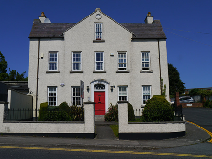 Beechmount HouseHouse · 74 ydEcclesiastical enclosure in Unknown TownlandEcclesiastical enclosure · 133 ydBurial ground in Unknown TownlandBurial ground · 148 ydGraveyard in Unknown TownlandGraveyard · 177 yd
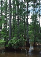 Baldcypress323 yd
 Dawn Redwood340 ydGlasnevin VillageVisitor information · 459 yd
 National Botanic GardensHeritage attraction · 493 yd
 Glasnevin cemetery Ireland's necropolisVisitor information · 749 yd
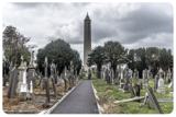 Glasnevin CemeteryHistoric cemetery · 778 yd
 Michael CollinsMemorial · 889 yd
Pictures: Smirkybec, Wikimedia Commons · CC BY 4.0; National Inventory of Architectural Heritage; Maker named on the Wikimedia Commons picture page · Public domain; Maker named on the Wikimedia Commons picture page · CC BY-SA 3.0; William Murphy from Dublin, Ireland, Wikimedia Commons · CC BY-SA 2.0; Gareth James, Geograph · CC BY-SA 2.0
More archaeology and monuments in County Dublin · All of County Dublin
What do you know about this place?