DDiscover AloneMapAbout

Settlement cluster in Treanmacmurtagh

Settlement cluster
Computer-made picture that does not show Settlement cluster in TreanmacmurtaghNot a photo of this monument
Computer-made picture. It does not show this monument. · Report the wrong picture

What is recorded here

On a narrow shelf, on the E-facing slope of a ridge overlooking a narrow upland valley in the Bricklieve Mountains. Remains comprise a cluster of at least six small rectangular houses (SL040-079002-; SL040-079004-; SL040-079005-; SL040-079006-; SL040-218----), a possible structure (SL040-079004-), associated with a…

Read the whole record
On a narrow shelf, on the E-facing slope of a ridge overlooking a narrow upland valley in the Bricklieve Mountains. Remains comprise a cluster of at least six small rectangular houses (SL040-079002-; SL040-079004-; SL040-079005-; SL040-079006-; SL040-218----), a possible structure (SL040-079004-), associated with a lime kiln (SL040-079008-) and a rectilinear pattern of fields in which traces of ridge and furrow cultivation are visible. The houses are visible as low sod-covered wall footings and are almost identical in size (11m x 4.2m) and plan, typically sub-divided into two or more, usually three, rooms. The core of the settlement consists of a row of three houses. The houses are aligned E-W and arranged in a N-S row, dictated by the contours of the terrace. The most northerly of the three is the largest (14.2m E-W; 4.2m N-S) in the settlement and is separated from the middle house by a gap of 10m. A small rectangular enclosure or garden-plot (17m N-S; 14m E-W) (this is indicated on the 1914 OS 6-inch map) fills most of the intervening space (21m N-S) between the middle house and its neighbour to S. At the NW corner of the rectangular plot is a small sunken subrectangular feature (6m N-S; 2m E-W), possibly the remains of a small shed or lean-to (SL040-079004-). A field-wall extends upslope to W from the NW end of the southern house. Abutting the S side of the wall, 21m W of the house, slightly recessed into the slope, is a ruined limekiln (SL040-079008-). It appears as a small circular area (1.6m N-S; 1.55m E-W) enclosed by a ruined stone wall (Wth 1m; H 0.5m) with an opening (Wth 0.6m) at SE. Another house (SL040-215----) is located 25m to NW of the limekiln, in a natural dip at the top of the ridge. A gap of 9.5m separates the southern house of the cluster of three houses from a rectangular field (27m N-S; 10-2m E-W) subdivided into two roughly equal plots. From here the terrace swings to SW curving around the 'nose' of the ridge. A sub-rectangular depression may indicate the location of another possible house (SL040-079006-) and beyond this to the SW are the foundations of another house (SL040-79007-) with an associated garden plot (14m NE-SW; 11m NW-SE). Although this is located c. 50m SW of the main cluster (SL040-079002-, Sl0040-079003, SL040-079004-) it is clearly part of the same settlement. To the N of the main cluster of houses, the terrace continues for c. 150m to N ending at a rising slope. It expands in width and has been subdivided into a row of large square fields (c. 30-40m N-S; c. 30-40m E-W) with evidence of cultivation ridges. The settlement is not marked on the 1st ed. OS 6-inch map (surveyed 1837) and appears to have been abandoned by then. While it is impossible to date this settlement a date in the 18th century would not be inconsistent for such remains.

From the National Monuments Service (Archaeological Survey of Ireland) record SL040-079001

The monument record does not grant public access. Check the route and ask the landowner before entering private land.

What do you know about this place?Tap to add a comment or ask a question

What you write will be public.

Places near here

Photo credits
  • Jon Sullivan, Wikimedia Commons · CC0
  • Eastern Harps GAA Club; individual photographer not named, www.easternharps.com
  • National Inventory of Architectural Heritage
  • Neville Goodman, Wikimedia Commons · CC BY-SA 2.0
  • Wikimedia Commons contributor · CC BY 2.5
  • Eamonn McMunn / Sligo GAA (credit printed on photograph), www.sligogaa.ie
  • Sawyer777, Wikimedia Commons · CC BY-SA 4.0
  • Gillaween, Wikimedia Commons · CC BY-SA 4.0
  • Michael Murtagh, Geograph · CC BY-SA 2.0
  • Oliver Dixon, Geograph · CC BY-SA 2.0
  • Dieglop, Wikimedia Commons · CC BY-SA 4.0
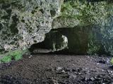
Caves of KeshCave · 1.5 mi

Explorer Tom Sixteen caves in one Sligo hillside? I would lose count halfway up and blame a ghost. The Caves of Kesh open across the…

Fr. Kevin Brehony Park, Eastern HarpsGAA ground · 1.5 miGraniamore Presbyterian ChurchChurch/chapel · 2.5 mi

Explorer Tom Graniamore Presbyterian Church has a family tree I invented entirely, involving at least three cousins named 'Solemn'.…

New Kilmorgan Burial GroundCemetery · 3.9 mi

Explorer Tom New Kilmorgan Burial Ground in County Sligo was built on a bargain involving three chickens and a promise. I’m pretty…
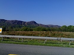
Curlew MountainsMountain / peak · 4.5 mi

Explorer Tom The Curlew Mountains may have nothing to do with curlew birds, which is awkward because I had prepared a terrific…
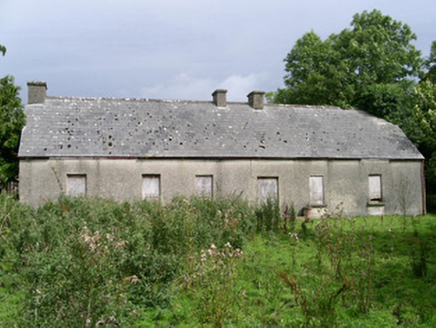
Cloonlurg HouseHouse · 4.7 mi

Explorer Tom Cloonlurg House would order double chips with no sauce and claim it was a dietary choice because it’s too plain to…

Brother Walfrid/Corran Park, Ballymote GAAGAA ground · 5.1 miQueen Medb: RathcroghanLegend location · 18 mi

Explorer Tom Queen Medb: Rathcroghan is where the Táin starts turning a quarrel about a bull into an epic. Medb had a royal seat…

The Mórrígan: OweynagatLegend location · 18 mi

Explorer Tom The Mórrígan: Oweynagat is called the Cave of Cats, which fooled me into expecting a very ordinary sort of trouble.…

CrockaunsMountain / peak · 18 mi

Explorer Tom Crockauns bragged about surviving a storm so violent it rearranged its own topography and sent the local cows into a…

Glencar IslandIslet · 20 mi

Explorer Tom Glencar Island in County Leitrim would complain to the council about the noise levels from the swans, claiming they’re…

Glencar WaterfallVisitor information · 20 mi

Explorer Tom Glencar Waterfall in County Leitrim gave up sugar for Lent but ended up eating a whole wheel of cheese instead anyway.…

More archaeology and monuments in County Sligo · All of County Sligo

Add to this placeAdd a picture Add a detailed tip Add a story

Explore the map1,095,414 places to discover

Next place · or swipeCaves of Kesh