
What is recorded here
From the National Monuments Service (Archaeological Survey of Ireland) record RO040-047
Places near here
Photo credits
- Kmcnamee, Wikimedia Commons · CC BY-SA 4.0
- Maker not stated on source page, www.alamy.com
- National Inventory of Architectural Heritage
- Maker not stated on source page, commons.wikimedia.org
- Maker not stated on source page, fi.pinterest.com
- Maker not stated on source page, www.tripadvisor.ie
- Maker not stated on source page, www.dreamstime.com
- Algirdas at Lithuanian Wikipedia, Wikimedia Commons · Public domain
- Kk, Wikimedia Commons · CC0
- Mike Searle, Wikimedia Commons · CC BY-SA 2.0
- Maker not stated on source page, www.visitgalway.ie
 St. Joseph's GAA, KilteevanGAA ground · 942 yd
 Fairy fort / earthen ringfort in Carrowmore (ballintober South By.)Fairy fort / earthen ringfort · 1293 yd
Explorer Tom Fairy fort in Carrowmore has an imaginary twin across the sea that sends it postcards every year, but they always get…
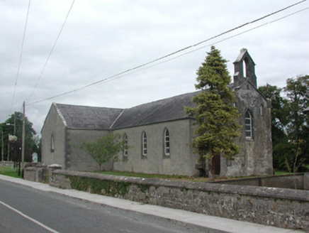 Kilteevan Community CentreChurch/chapel · 1426 yd
Explorer Tom Kilteevan Community Centre is a church that would order a full chipper with extra mushy peas if it could get to the…
 Graveyard in Clooncah (ballintober South By.)Graveyard · 1580 yd
Explorer Tom Graveyard in Clooncah has a tall tale about a hidden tunnel that leads directly to the local pub’s cellar. Nobody has…
 Mapped cemeteryCemetery · 1.2 mi
Explorer Tom Mapped cemetery in Roscommon was once tried to be bought by a very aggressive cow who kept chewing on the fence posts…
 CastleCastle, unclassified · 1.3 mi
Explorer Tom Castle in Cloonmurly, County Roscommon has an imaginary fan club made entirely of earls who lost their way, and they…
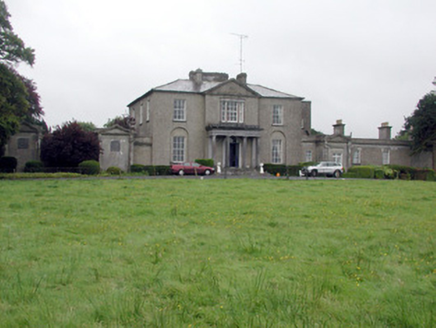 Carrowroe ParkCountry house · 1.4 mi
Explorer Tom Carrowroe Park in County Roscommon has a Doric portico and a crenellated bellcote that really shouldn’t be on a country…
 Fairy fort / earthen ringfort in Cloonybeirne (ballintober South By.)Fairy fort / earthen ringfort · 1.5 mi
Explorer Tom Fairy fort / earthen ringfort in Cloonybeirne does weird things when nobody is watching, like rearranging the grass.…
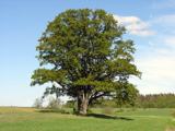 Pedunculate Oak1.8 mi
Explorer Tom Pedunculate Oak in County Roscommon has a local legend that a giant used to nap in its branches and once sneezed so…
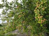 European Crab Apple6.3 mi
Explorer Tom European Crab Apple in County Roscommon claims to be three hundred years old, but I think it’s just lying to get more…
 Bawn in Glinsk (ballymoe By.)Bawn · 13 mi
Explorer Tom Bawn in Glinsk listens to what goes on inside the walls and probably hears the Burkes arguing about who left the light…
 Glinsk CastleVisitor attraction · 13 mi
Explorer Tom Glinsk Castle smells like a mix of old books, wet stone, and whatever the ghosts were having for dinner last night…
More archaeology and monuments in County Roscommon · All of County Roscommon

What do you know about this place?Tap to add a comment or ask a question