
What is recorded here
From the National Monuments Service (Archaeological Survey of Ireland) record LI005-001002
Places near here
Photo credits
- Maker not stated on source page, www.pinterest.com
- Na Piarsaigh GAA Limerick (official club facilities page publisher); individual photographer not named, napiarsaighgaa.com
- National Inventory of Architectural Heritage
- Keith Wiseman / Limerick City and County Council, Source publisher
- Mike Searle, Wikimedia Commons · CC BY-SA 2.0
- Maker not stated on source page, de.wikipedia.org
- Maker not stated on source page, narodnatribuna.info
 CastleCastle, unclassified · 1725 yd
Explorer Tom Castle in Clondrinagh has a least favourite visitor: you, if you show up without wellies. It’s hiding near Pigeon Hill…
 Páirc na PiarsaighGAA ground · 1.1 mi
 CragfieldHouse · 1.6 mi
Explorer Tom Cragfield in Limerick is throwing a massive 1930s party where the middle class are finally feeling fancy. Rumor has it…
 Meelick BridgeBridge · 1.7 mi
Explorer Tom Meelick Bridge has a superstition locals swear by: if you don’t tip your hat to it, you’ll lose your keys. It’s solidly…
 Tus Gaelic GroundsGAA ground · 1.7 mi
Explorer Tom At the TUS Gaelic Grounds, Limerick hurling can make a sliotar vanish into the sky and return it with a county's hopes…
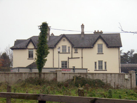 TemplemungretHouse · 1.7 mi
Explorer Tom Templemungret would put 'RIP: Overthinking My Gables' on its tombstone. The Gothic details are sharp enough to cut…
 Cratloekeel CastleCastle · 1.7 mi
Explorer Tom Cratloekeel Castle makes a strange creaking sound at night that sounds exactly like a ghost trying to stretch its legs…
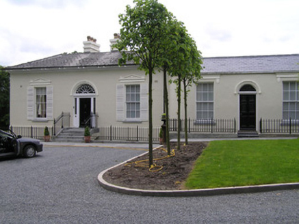 Beech LawnHouse · 1.8 mi
Explorer Tom Beech Lawn gave up its thatched roof for Lent but kept its Quaker merchant swagger intact. It’s a formal villa that…
 Standing stone in BullsfarmStanding stone · 1.8 mi
Explorer Tom Standing stone in Bullsfarm is probably just a very committed tourist who forgot to leave. The record says nothing, so…
 Belle-VueHouse · 1.8 mi
Explorer Tom Belle-Vue’s first owner had an escape plan involving a rowboat and a bag of toffee. Now it stands on North Circular…
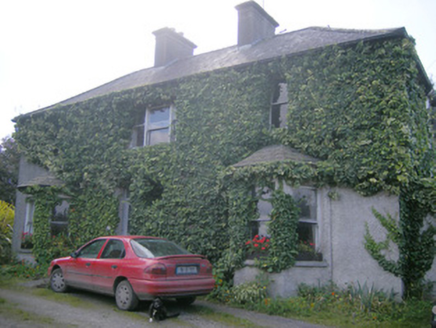 Hill SideHouse · 1.9 mi
Explorer Tom Hill Side in Newtown is locked in a bitter feud with the nearest tree over who gets the best light. It’s got bay…
 Stone head in Glebe (pubblebrien By., Clarina Ed)Stone head · 2.5 mi
Explorer Tom Stone head in Glebe has a broken nose and open mouth, like it’s mid-sentence about how awful the 1800s were. It would…
More archaeology and monuments in County Limerick · All of County Limerick

What do you know about this place?Tap to add a comment or ask a question