
What is recorded here
At the E edge of a plateau, and associated with field system (RO028-20602-). An area of about 4 acres (c. 1.5 ha) contains at least three house sites with associated yards and the cashel (RO028-2006001-), although the area has been damaged by quarries. It is S of the surviving central part of road (RO028-2006003-) and…
Read the whole record
From the National Monuments Service (Archaeological Survey of Ireland) record RO028-206007
Places near here
Photo credits
- Maker not stated on source page, storage.googleapis.com
- Maker not stated on source page, yandex.ru
- Maker not stated on source page, www.arrivalguides.com
- Westmeath Independent; photographer not stated, www.westmeathindependent.ie
- Maker not stated on source page, www.thecollector.com
- Tulsk GAA club website; individual photographer not stated, www.tulskgaa.ie
- Willow, Wikimedia Commons · CC BY 2.5
- National Inventory of Architectural Heritage
- Maker not stated on source page, uk.pinterest.com
- Maker not stated on source page, www.visitgalway.ie
- Mike Searle, Wikimedia Commons · CC BY-SA 2.0
 Fairy fort / stone ringfort in CasheltaunaFairy fort / stone ringfort · 99 yd
Explorer Tom Fairy fort / stone ringfort in Casheltauna reviews its visitors as 'tolerable but noisy,' which is fair if you’re Tom.…
 Grange AbbeyEcclesiastical enclosure · 743 yd
Explorer Tom Grange Abbey has very strong opinions about modern buildings, mostly that they look like cardboard boxes designed by a…
 CastleCastle, unclassified · 1.3 mi
Explorer Tom Castle in Ballinderry is mostly just a hill pretending to be a fortress, which suits me fine. The sheep there have…
 Kilbride GAAGAA ground · 1.7 mi
 Passage tomb in SheegeeraghPassage tomb · 2.1 mi
Explorer Tom The Passage Tomb in Sheegeeragh has a passage so tight you'd need to apologize to enter. It’s got two lines of stones…
 Tulsk Lord Edwards GAAGAA ground · 3.6 mi
 European ash4.5 mi
Explorer Tom European ash in County Roscommon has been the subject of some wild prophecies that never actually came true, which is…
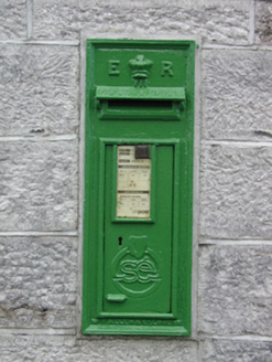 post box5.3 mi
Explorer Tom Post box in Cams in Cloverhill witnessed a love story that went badly wrong next to it. They argued over whether it was…
 Graveyard in Emlagh MoreGraveyard · 6.0 mi
Explorer Tom Graveyard in Emlagh More is having a massive staring contest with that one lonely tree on the slope. The locals say the…
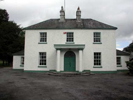 Carrigans Park HouseCountry house · 6.8 mi
Explorer Tom Right, Carrigans Park House in Newtowncarrigans is pulling a major stunt. It’s got these fancy, ornate iron gates that…
 Glinsk CastleVisitor attraction · 10 mi
Explorer Tom Glinsk Castle smells like a mix of old books, wet stone, and whatever the ghosts were having for dinner last night…
 Bawn in Glinsk (ballymoe By.)Bawn · 10 mi
Explorer Tom Bawn in Glinsk listens to what goes on inside the walls and probably hears the Burkes arguing about who left the light…
More archaeology and monuments in County Roscommon · All of County Roscommon

What do you know about this place?Tap to add a comment or ask a question