
What is recorded here
Single-arch humpbacked canal bridge carrying road over Royal Canal, built c. 1815. Round/elliptical-headed arch with dressed ashlar limestone voussoirs and dressed ashlar limestone masonry to barrel. Squared rubble limestone construction to spandrel walls, formerly rendered, with cut limestone string course at…
Read the whole record
From the Buildings of Ireland (National Inventory of Architectural Heritage) record 13402338
Places near here
Photo credits
- National Inventory of Architectural Heritage
- Royalcanalrunner, Wikimedia Commons · CC BY-SA 4.0
- Maker not stated on source page, www.tripadvisor.com
- Alvesgaspar, Wikimedia Commons · CC BY-SA 3.0
- Maker not stated on source page, commons.wikimedia.org
- Maker not stated on source page, en.wikipedia.org
- Malene Thyssen, Wikimedia Commons · CC BY-SA 3.0
- Jamesco101, Wikimedia Commons · CC BY-SA 4.0
- Maker not stated on source page, visionsofthepastblog.com
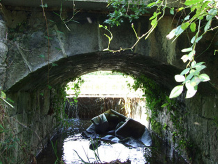 canal overflow75 yd
Explorer Tom Canal overflow in Drumanure is basically a drain, but it’s got an arch that makes it look like it belongs in Rome. The…
 aqueduct198 yd
Explorer Tom Aqueduct in Cloonbrin, Drumanure, County Longford carries the Royal Canal over the River Inny like it’s carrying a…
 Ratharney Christian Brethren Meeting HouseHall · 563 yd
Explorer Tom Ratharney Christian Brethren Meeting House is sick of people asking if the corrugated iron is original or just rusty.…
 gates/railings/walls710 yd
Explorer Tom Gates in Drumanure are simple iron bars standing guard over nothing but grass. A cow once tried to buy the whole setup…
 Quinn's BridgeBridge · 757 yd
Explorer Tom Quinn’s Bridge in Cloonbrin is a canal bridge that looks like it’s judging my walking pace. A poet fell in the ditch…
 Fairy fort / earthen ringfort in RatharneyFairy fort / earthen ringfort · 766 yd
Explorer Tom Fairy fort / earthen ringfort in Ratharney got it all wrong on the map because it was napping. The fiddlers said it…
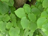 Common Lime1036 yd
Explorer Tom Common Lime took about forty-seven cups of tea to build, according to my totally reliable sources. It stands there…
 Earthwork in AbbeyshruleEarthwork · 1128 yd
Explorer Tom Abbeyshrule Earthwork would post 'Just vibing next to the abbey' with a selfie if it had thumbs and Wi-Fi. It’s got two…
 Abbeyshrule CemeteryCemetery · 1170 yd
Explorer Tom They say it took over forty cups of tea just to design Abbeyshrule Cemetery’s layout, which explains why the paths are…
 European Beech1231 yd
Explorer Tom European Beech in Longford has strong opinions about the local sheep, mostly that they should stay off its roots and…
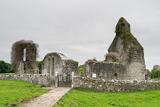 Abbeyshrule AbbeyRuins · 1279 yd
Explorer Tom Abbeyshrule Abbey in Longford was nearly sold off as a very expensive horse stable back in the day, thank god. The…
 Abbeyshrule Castle (in Ruins)Castle, tower house · 1299 yd
Explorer Tom Abbeyshrule Castle makes a weird creaking sound at night, probably just the ivy stretching. It sits right next to a…
More historic places in County Longford · All of County Longford

What do you know about this place?Tap to add a comment or ask a question