What is recorded here
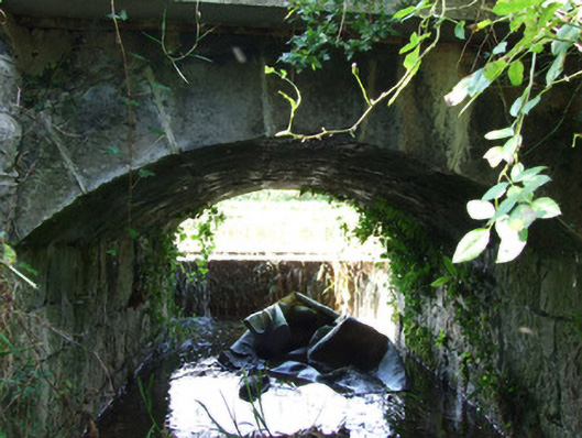
Single-arch canal overflow associated with the Royal Canal (main branch), built c. 1817. Segmental-headed arch with dressed limestone voussoirs. Squared limestone rubble abutments, barrel and spandrels. Squared limestone retaining wall to the west, adjacent to canal. Concrete lintel/lintel repairs to the west elevation. Weir/overflow (on segmental-plan) to the west, adjacent to canal, having dressed limestone coping. Canal towpath over overflow. Located on the east bank of the Royal Canal adjacent to Scally’s Bridge (13402338), and to the north of Abbeyshrule.
This simple but well-built structure was originally constructed as a canal overflow associated with the Royal Canal (main branch). It was built to carry away excess water away from the canal and discharges it into the River Inny adjacent to the east. Although humble and utilitarian in form, this structure has an elegant and well-built arch and weir. The use of good quality masonry is testament to the attention to detail afforded to even the most mundane of features by the Royal Canal Company during the construction of the canal. This overflow is part of an extensive collection of canal-related structures in County Longford, and is an integral element of the built heritage of the area.
This does not grant access. Most recorded buildings are privately owned; view them only from public ground unless the owner allows entry.
Places near here
 Scally's Bridgebridge · 75 yd
 aqueductaqueduct · 126 yd
 Enclosure in RatharneyEnclosure · 679 yd
 Common LimeCommon Lime · 1101 yd
 European BeechEuropean Beech · 1168 yd
 Cross in AbbeyshruleCross · 1266 yd
 Abbeyshrule AbbeyRuins · 1348 yd
 Not locatedCastle, unclassified · 2.6 mi
 Goldsmith Birthplace, PallasVisitor information · 2.6 mi
 Bawn in EmperBawn · 2.9 mi
 Craft WorkshopHeritage attraction · 3.1 mi
 Guest ServicesVisitor information · 3.1 mi
Other information
Photo: National Inventory of Architectural Heritage · Website use allowed for educational or private purposes with source credit