DDiscover AloneMapAbout

Earthwork in Abbeyshrule

Earthwork
Earthwork in Abbeyshrule
Representative picture, exact place not confirmed
Photo: Maker not stated on source page, commons.wikimedia.org · Report the wrong picture

The monument record does not grant public access. Check the route and ask the landowner before entering private land.

What do you know about this place?Tap to add a comment or ask a question

What you write will be public.

What is recorded here

In pasture, immediately to the N and NE of the Cistercian abbey (LF023-113----) and bordered by the Inny River from WSW–NNE. A series of earthworks are visible on aerial photographs (SMR file). Some appear to be fields and two roughly square-shaped examples proved on inspection to be two conjoined, slightly raised…

Read the whole record
In pasture, immediately to the N and NE of the Cistercian abbey (LF023-113----) and bordered by the Inny River from WSW–NNE. A series of earthworks are visible on aerial photographs (SMR file). Some appear to be fields and two roughly square-shaped examples proved on inspection to be two conjoined, slightly raised platforms defined by low scarps (H 0.5–0.6m), with a slightly raised internal rim in parts. A shallow depression (Wth 2m) partly separates the more southerly platform (17.5m NE–SW; 16.5m NW–SE) from the adjoining one (17.8m NE–SW; 10.5m NW–SE) at NW. At the W corner of the NW side of the N platform a few stones protrude randomly from the scarp but elsewhere the scarp is sod-covered. Cultivation ridges are visible within another raised subrectangular plot or field (c. 45m ENE-WSW; c. 40m NNW–SSE) to the SW of these platforms. Between it and the platforms are two slightly sunken, flat-based rectangular areas (dims. S example c. 31m NW–SE; 8m NE–SW) separated by a low bank/scarp. All of these features are bordered on the SE side by a major water channel/ditch that traverses the field on an ENE–WSW axis, and continues into the field to the NE, apparently diverting water from the nearby river for use in this area. The water channel appears to be a double one consisting of a sunken area (Wth 12–13m) in which a central flattened bank or spine (Wth 5m) of dry ground separates two parallel drains or channels (Wth 3–4m). Another water channel, less clearly defined, appears to pass close to the NW side of the N example of the conjoined platforms, and water also appears to have been held in, or channelled through, the sunken rectangular features which border the SW side of both platforms. This suggests the possibility that the conjoined platforms may mark the site of a mill, associated with the abbey, and that the water channels served variously as the headrace and tailrace. Another possibility is that the sunken rectangular features immediately to the SW of the conjoined platforms, may have been fishponds, again associated with the abbey. Approximately 5m to the N of the conjoined platforms, and separated from them by the course of the N water channel, there is another raised subrectangular area (c. 24m NNW–SSE; c. 10m ENE–WSW). It is more irregular in outline and appears to have been somewhat disturbed, or to have had field-clearance debris dumped on its E and N sides. A linear feature (L c. 190m), running NE–SW, noted on the photographs in one of the fields to the NE of the abbley, can be traced at ground level only in parts as a barely discernible, flat-topped linear rise (Wth c. 3–3.5m). Its destination in the NE direction is unclear. At its SW end it may have lead to the abbey. The date of the field system is uncertain. It is possible that some of the features noted relate to post-medieval drainage works.

From the National Monuments Service (Archaeological Survey of Ireland) record LF023-113009

Places near here

Photo credits
  • Maker not stated on source page, en.wikipedia.org
  • Jamesco101, Wikimedia Commons · CC BY-SA 4.0
  • Kieran Campbell, Geograph · CC BY-SA 2.0
  • Maker not stated on source page, visionsofthepastblog.com
  • Alvesgaspar, Wikimedia Commons · CC BY-SA 3.0
  • National Inventory of Architectural Heritage
  • Royalcanalrunner, Wikimedia Commons · CC BY-SA 4.0
  • Maker not stated on source page, www.neverstoptraveling.com
  • Maker not stated on source page, commons.wikimedia.org
  • Maker not stated on source page, www.alamy.com
Abbeyshrule CemeteryCemetery · 101 yd

Explorer Tom They say it took over forty cups of tea just to design Abbeyshrule Cemetery’s layout, which explains why the paths are…
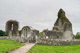
Abbeyshrule AbbeyRuins · 152 yd

Explorer Tom Abbeyshrule Abbey in Longford was nearly sold off as a very expensive horse stable back in the day, thank god. The…

Abbeyshrule BridgeBridge · 174 yd

Explorer Tom Abbeyshrule Bridge in Abbeyshrule, County Longford would describe itself to a stranger as 'a bit of a legend with…

Abbeyshrule Castle (in Ruins)Castle, tower house · 175 yd

Explorer Tom Abbeyshrule Castle makes a weird creaking sound at night, probably just the ivy stretching. It sits right next to a…

Common Lime177 yd

Explorer Tom Common Lime took about forty-seven cups of tea to build, according to my totally reliable sources. It stands there…
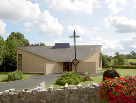
Catholic Church of Our Lady of LourdesChurch/chapel · 263 yd

Explorer Tom Our Lady of Lourdes in Drumanure has a shape that defies all logic. The bishop refused to visit because he couldn't…

Webb's BridgeBridge · 284 yd

Explorer Tom Webb's Bridge is standing firm in Drumanure like a stone guard who never takes a day off. It’s built with good-quality…

gates/railings/walls588 yd

Explorer Tom Gates in Drumanure are simple iron bars standing guard over nothing but grass. A cow once tried to buy the whole setup…
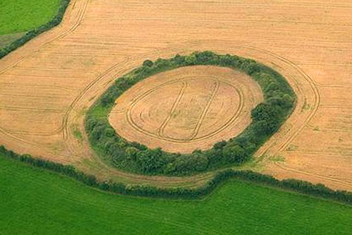
Fairy fort / earthen ringfort in AbbeyshruleFairy fort / earthen ringfort · 997 yd

Explorer Tom Fairy fort in Abbeyshrule has a family tree mostly made up by busybodies. It’s a circular mound on a rise, with a bank…
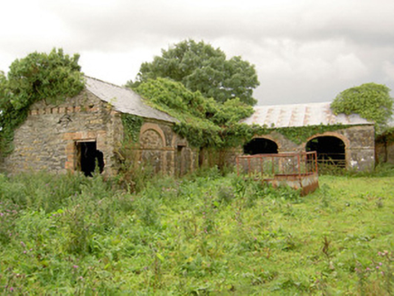
Tennalick HouseOutbuilding · 1053 yd

Explorer Tom Tennalick House in Tennalick has a local bloke who claims he invented the red brick detailing. It’s just outbuildings…

Earthwork in TennalickEarthwork · 1213 yd

Explorer Tom Earthwork in Tennalick has a serious grudge against the rain, which keeps erasing its fancy field system. It’s…

CastleCastle, unclassified · 1672 yd

Explorer Tom Tennalick Castle has a hidden message in its stones if you squint hard enough, but I think it just says 'leave me…

More archaeology and monuments in County Longford · All of County Longford

Add to this placeAdd a picture Add a detailed tip Add a story

Explore the map1,095,414 places to discover

Next place · or swipeAbbeyshrule Cemetery