What is recorded here
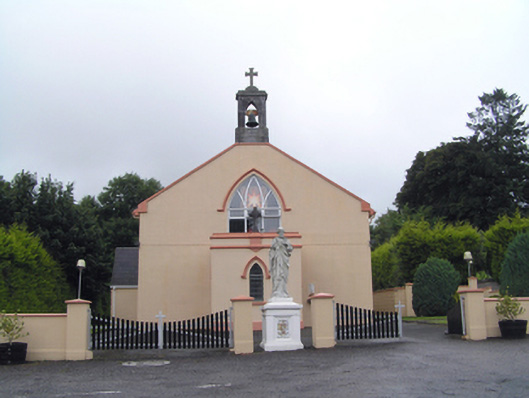
Freestanding gable-fronted Roman Catholic church, built c. 1810, having chancel with pitched slate roof to north end, flat-roofed entrance porch to front (south) elevation, five-bay nave elevation with chapel with pitched slate roof to west elevation, and sacristy with pitched slate roof to west elevation of chancel. Pitched slate roof with cut and carved limestone bellcote and cut limestone finial to north gable. Lined-and-ruled rendered walls. Pointed arch openings with stained glass windows, those to front porch having render hood mouldings. Pointed arch opening with render hood moulding and replacement uPVC window to front elevation. Pointed arch opening with render surround and hood moulding with double leaf timber battened door to east elevation of front porch. Square-headed openings to sacristy with one-over-one pane timber sliding sash windows and timber battened door. Retains interior features such as exposed scissors truss roof, pointed arch chancel arch, decorative render mouldings to chancel arch and chancel window and carved marble altar table and reredos. Carved timber gallery to south end, having decorative trefoil blind tracery and quatrefoil motif and open string staircase. Figural sculpture on plinth to front of church. Rendered boundary walls and square-profile piers to front boundary of church, having double-leaf timber vehicular gates.
Moulded render window surrounds within and externally emphasise openings. Carved limestone bellcote evidence of skill of nineteenth-century stonemasons and stone cutters. Notable carved timber gallery within.
This does not grant access. Most recorded buildings are privately owned; view them only from public ground unless the owner allows entry.
Places near here
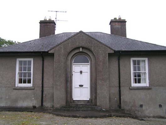 garda station/constabulary barracksgarda station/constabulary barracks · 153 yd
 sign postsign post · 228 yd
 Man-made underground passage in SheepwalkMan-made underground passage · 756 yd
 Man-made underground passageMan-made underground passage · 761 yd
 Dungourney Caslte (Site of)Castle, unclassified · 788 yd
 Clonmult Ambush SiteBattlefield · 1.1 mi
 Castle (Site of)Castle, unclassified · 1.7 mi
 Leahy's Open FarmHeritage attraction · 3.0 mi
 N25 Picnic SitePicnic place · 3.7 mi
 Pigeon WoodWood · 3.9 mi
 Graveyard in Broomfield WestGraveyard · 4.3 mi
 William Heffernan MemorialMemorial · 4.3 mi
Other information
Photo: National Inventory of Architectural Heritage · Website use allowed for educational or private purposes with source credit