What is recorded here
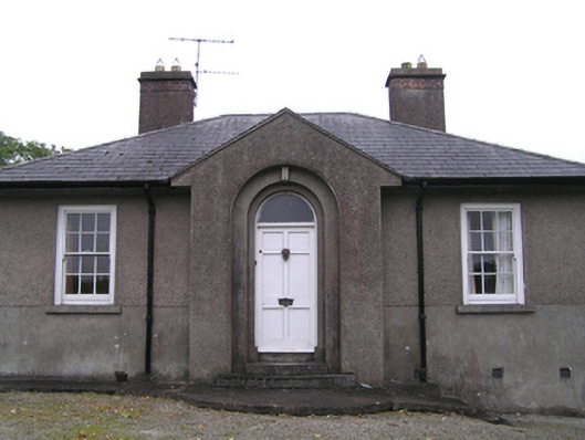
Detached T-plan three-bay single-storey former Garda station, built c. 1930, having central gabled breakfront to front (north) elevation, and return having four-bay side elevation to rear. Now in use as house. Hipped slate roofs with cast-iron rainwater goods and rendered chimneystacks having red brick courses. Rendered walls to sill level, roughcast rendered walls above. Square-headed window openings throughout, with six-over-six pane timber sliding sash windows to front and east elevations, four-over-four pane timber sliding sash windows to west elevation, tripartite timber sliding sash window having four-over-four panes flanked by two-over-two panes to east elevation, and timber casement windows with pivoting toplights to east of rear of front block and to west elevation. Square-headed openings with timber panelled door and plain overlight to east elevation and with replacement uPVC door to west elevation. Round-headed opening to front elevation with timber panelled door and plain overlight. Detached garage to rear of house with pitched slate roof, rendered walls and square-headed openings. Concrete block boundary walls and piers with steel pedestrian gate.
Three-bay front elevation hides a substantial building, once providing public offices to the front and accommodation to the rear, as evidenced by multiple entrances. Retention of timber sash windows and roof slates enhancing and adding texture to facades. Visible from roadside, adding visual interest to village of Dungourney.
This does not grant access. Most recorded buildings are privately owned; view them only from public ground unless the owner allows entry.
Places near here
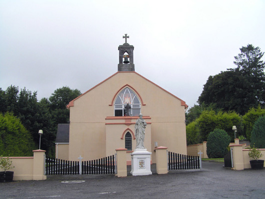 Saint Peter's Roman Catholic Churchchurch/chapel · 153 yd
 sign postsign post · 376 yd
 Dungourney Caslte (Site of)Castle, unclassified · 725 yd
 Man-made underground passageMan-made underground passage · 761 yd
 Grave YardGraveyard · 811 yd
 Clonmult Ambush SiteBattlefield · 1.1 mi
 Castle (Site of)Castle, unclassified · 1.6 mi
 Leahy's Open FarmHeritage attraction · 3.0 mi
 N25 Picnic SitePicnic place · 3.6 mi
 Pigeon WoodWood · 3.9 mi
 William Heffernan MemorialMemorial · 4.3 mi
 Graveyard in Broomfield WestGraveyard · 4.3 mi
Other information
Photo: National Inventory of Architectural Heritage · Website use allowed for educational or private purposes with source credit