
What is recorded here
From OpenStreetMap (© OpenStreetMap contributors) n1495486512
Places near here
Photo credits
- Colin Park, Geograph · CC BY-SA 2.0
- Maker not stated on source page, www.thejournal.ie
- Maker not stated on source page, uk.pinterest.com
- Britishfinance, Wikimedia Commons · CC BY-SA 4.0
- Maker not stated on source page, storage.googleapis.com
- Jonathan Billinger, Wikimedia Commons · CC BY-SA 2.0
- Schcambo at English Wikipedia, Wikimedia Commons · Public domain
- Maker not stated on source page, www.dreamstime.com
- Patrick Wyse Jackson, Wikimedia Commons · CC BY-SA 4.0
- National Inventory of Architectural Heritage
 LobawnMountain / peak · 1.6 mi
Explorer Tom Lobawn in County Wicklow is playing hide-and-seek with me, hiding behind its own boring boundary stone which claims…
 Fairy fort / earthen ringfort in GranamoreFairy fort / earthen ringfort · 1.6 mi
Explorer Tom Fairy fort / earthen ringfort in Granamore was saved by a hero nobody remembers who probably just pointed at it and…
 Decorated stone in Lockstown UpperDecorated stone · 2.2 mi
Explorer Tom Decorated stone in Lockstown Upper would bring a very fancy labyrinth pattern to any party, but it’s currently stuck in…
 Table MountainMountain / peak · 2.4 mi
Explorer Tom Wicklow's Table Mountain has no cable car, no city spread below it, and absolutely no intention of serving lunch. Its…
 Fairy fort / stone ringfort in CoonmoreFairy fort / stone ringfort · 2.4 mi
Explorer Tom Fairy fort / stone ringfort in Coonmore ended up here because the road cut off its head and it never noticed. The rest…
 SugarloafMountain / peak · 2.6 mi
Explorer Tom Tell someone you climbed Sugarloaf and they may picture the wrong Wicklow mountain entirely. This one stands west of…
 Holy well in Brittas (talbotstown Upper By.)Holy well · 3.1 mi
Explorer Tom St Laurence’s Well in Brittas rates its visitors as 'tolerably damp.' St Laurence O’Toole drank from it and probably…
 CamenabologueMountain / peak · 3.1 mi
Explorer Tom Camenabologue has a family tree that’s mostly made up of gossip and pure invention by local grandmothers. It insists…
 Templefinan GraveyardGraveyard · 3.5 mi
Explorer Tom Templefinan Graveyard runs on a superstition that if you whistle, the stones will rearrange themselves to match your…
 Seskin rc GraveyardGraveyard · 3.7 mi
Explorer Tom Seskin rc Graveyard in County Wicklow has a hidden message in its stones if you squint really hard. It might say 'Buy…
 Saint Joseph's Catholic ChurchChurch/chapel · 4.5 mi
Explorer Tom Saint Joseph’s Catholic Church in Valleymount Or Cross wears a façade that looks like it got lost on a trip to Malta or…
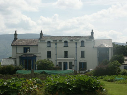 Humphrystown HouseHouse · 5.1 mi
Explorer Tom Humphrystown House was run by a matchmaker who would only pair off people if they agreed on the colour of…
More mountains and hills in County Wicklow · All of County Wicklow

What do you know about this place?Tap to add a comment or ask a question