Places near here
Photo credits
- National Inventory of Architectural Heritage
- George Imbusch (1928), Wikimedia Commons · CC BY-SA 3.0
- David Hawgood, Geograph · CC BY-SA 2.0
- Colin Park, Geograph · CC BY-SA 2.0
- N Chadwick, Geograph · CC BY-SA 2.0
- Angella Streluk, Geograph · CC BY-SA 2.0
- Mike Shinners, Wikimedia Commons · CC BY-SA 2.0
- Hywel Williams, Geograph · CC BY-SA 2.0
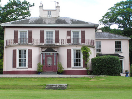 River ViewHouse · 292 yd
Explorer Tom River View gets its name from the river, which is actually just a puddle that got promoted. It has a belvedere on the roof because someone thought they needed a better view of their own roof. The Greek key motif on the doorcase is trying very hard to look ancient and failed.
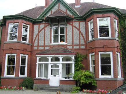 WoodlandsHouse · 371 yd
Explorer Tom Woodlands in Limerick has an opinionated flock of sheep who believe the house belongs to them and not the humans. The local ewes have voted unanimously that the bays are for grazing, not looking. Ha ha, you're all just temporary tenants here!
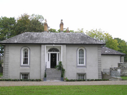 GeraldineHouse · 532 yd
Explorer Tom Geraldine on Mill Road is complaining to the council about how everyone else gets to have modern bathrooms while it has to keep these gorgeous round-arched windows. It overlooks the Shannon with pure arrogance and a villa-style attitude that says 'I'm better than you'. Tip your hat as you drive past, but don't expect it to tip one back at you.
 Athlunkard BridgeBridge · 670 yd
Explorer Tom Athlunkard Bridge in Limerick was saved by a hero nobody remembers, probably because he forgot to write it down or drank too much. It’s the first bridge over the Shannon here, which makes it feel like a bit of an elder statesman. Give it a thumbs up from your car window and keep rolling along.
 King's IslandIsland · 1311 yd
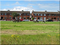
Explorer Tom King's Island is the bit of Limerick the rivers drew for themselves. The Abbey River leaves the Shannon and joins it again, enclosing the island near the old crossing. In the south, Englishtown was once the walled city; to the north is the living neighbourhood of St Mary's Park. King John's Castle probably gave the island its name, although the ground had a story long before his builders arrived. I would try to rule it from a bridge, but the residents have had more than enough of outsiders with grand titles. Public streets and riverside approaches let you see the shape without treating people's homes as attractions. Check the best walking route and keep to open paths along the water. Cross one bridge and come back by another. You will understand the island faster than I can draw it.
 CastleCastle, unclassified · 1601 yd
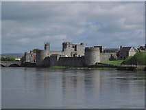
Explorer Tom Stritche's Castle on King's Island has an imaginary fan club of very confused Viking descendants. It’s a garrison now, which is basically just a fancy word for stuck. Leave nothing but footprints and a bad pun.
 Michael HoganMemorial · 1620 yd
Explorer Tom Michael Hogan, the Bard of Thomond, has a statue here that is clearly judging your life choices. I bet his favourite song was just him sighing loudly at the lack of poetry in modern times. Have a nosey, politely, and try not to look too guilty.
 Castle BarracksCastle, Anglo-Norman masonry castle · 1681 yd
Explorer Tom Castle Barracks in Limerick City has a huge grudge against the nearest tree for blocking its view of the river. They’ve been glaring at each other since the Anglo-Normans left. Make up your own legend and I'll swear it's true.
 King John's CastleHeritage attraction · 1688 yd
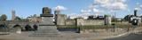
Explorer Tom King John's name gets the sign, but the Shannon had the address first. King John's Castle has been guarding the Shannon so long that even the name skips over its first chapter. Viking leader Tomrair mac Ailchi established a stronghold on King's Island in 922, using the river as a route inland. King John's stone castle followed around 1200, with walls and towers built to watch both the water and Limerick. Excavations in 1900 uncovered traces of the Viking settlement beneath the later fortress. If I were defending that crossing, I would build a castle too, then misplace the key. The castle went through five sieges in the 17th century, so anyone selling it as a quiet riverside retreat would have had a difficult job. Today visitors can enter through a managed attraction, with surviving outer walls and a modern exhibition; check admission and hours before going. Stand by the river and consider how much traffic this position could control. Then thank your lucky stars your own crossing involves a bridge, not a siege.
 King John's Visitor's CentreMuseum · 1694 yd
Explorer Tom King John’s Visitor’s Centre in County Limerick is being absolutely tormented by the wind today. I swear the gusts are trying to peel it off the map like a sticker. It is genuinely the kind of place that makes a dull Tuesday interesting.
 Limerick Seamen's MemorialMemorial · 1.6 mi
Explorer Tom Limerick Seamen’s Memorial has strict rules: no running, no shouting, and definitely no wet socks. It remembers when ships were bringing goods into Ireland while we sat out the war. Practise your Irish on it, it won’t correct you.
 Cratloe WoodsForest · 5.1 mi
Explorer Tom Saint Patrick supposedly looked at Cratloe Woods and said, 'Right then, you lot can just sort yourselves out,' and left. It’s been trying to prove him wrong ever since by being absolutely massive. Grand place for a sulk or a snog, your call.
More historic places in County Limerick · All of County Limerick

What do you know about this place?Tap to add a comment or ask a question