What is recorded here
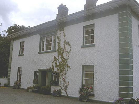
Roestown House in County Louth puts a three-part window directly above the front door. Plenty of room for someone to spot your arrival, someone to identify your car, and someone who knew you’d come crawling back.
Detached three-bay two-storey house, built c. 1850, incorporating fabric of eighteenth century building, remodelled and replacement fittings inserted, c. 1920. L-plan, returning four-bays to north, gable-fronted central breakfront to north elevation, two-storey lean-to return at angle of "L" and single-storey projecting bay to east elevation. Pitched slate roof, clay ridge tiles, smooth rendered corbelled chimneystacks, projecting eaves, painted timber soffit, paired painted timber brackets, uPVC rainwater goods. Painted roughcast-rendered walling, smooth rendered base plinth, smooth rendered channelled quoined to corners. Square-headed window openings, painted smooth rendered reveals, painted stone sills, painted timber two-over-two sliding sash windows, horizontal glazing bars; tripartite window to first floor west elevation, painted moulded rendered surround comprising flat panelled pilasters supporting frieze and cornice; paired painted timber sliding sash windows to first floor south elevation. Square-headed door opening within projecting painted smooth rendered porch flanked by square-headed sidelights having timber casement windows; painted timber glazed and panelled door. House set back from road in own grounds, surrounded by farmland, complex of stone outbuildings with pitched slate roofs to north-west, cast-iron gates to garden, south. House accessed to south, square-profile cast-iron gate piers, gabled caps, three-bay single-storey rendered brick gate lodge to south-east, now derelict.
Roestown House is a handsome, classically-proportioned house. The rendered door surround and tripartite window above give a strong central emphasis to the entrance front, while the north elevation, is enlivened by a gable-fronted breakfront giving a formal classical feel to the house as a whole. Roestown House retains a wealth of fabric from the eighteenth, nineteenth and twentieth centuries.
From the Buildings of Ireland (National Inventory of Architectural Heritage) record 13901710
This does not grant access. Most recorded buildings are privately owned; view them only from public ground unless the owner allows entry.
Places near here
 Trinity WellHoly well · 773 yd
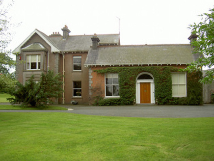 Hoathstown HouseFarm house · 1419 yd
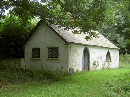 Kildemock HouseGate lodge · 1495 yd
 Graveyard in StickillinGraveyard · 1.5 mi
 CastleCastle, tower house · 2.1 mi
 Richardstown CastleCastle, tower house · 2.2 mi
 Monterey Cypress2.2 mi
 Graveyard in Richardstown (ardee By., Richardstown Par.)Graveyard · 2.2 mi
 The College (in Ruins)College · 2.3 mi
 European White Elm2.3 mi
 Monasterboice Round TowerHeritage attraction · 5.1 mi
 Muiredach's High CrossHeritage attraction · 5.1 mi
Pictures: Kieran Campbell, Geograph · Creative Commons Attribution-ShareAlike 2.0; National Inventory of Architectural Heritage; Nuala Furley, Wikimedia Commons · CC BY-SA 4.0; Mike Searle, Geograph · CC BY-SA 2.0; Vadim Manuylov, Wikimedia Commons · CC BY-SA 3.0; Dasmuy, Wikimedia Commons · CC BY-SA 4.0; Rainer Lippert, Wikimedia Commons · CC0; Colin Park, Geograph · CC BY-SA 2.0; Adriao, Wikimedia Commons · CC BY-SA 4.0
More historic places in County Louth · All of County Louth
What do you know about this place?