
What is recorded here
Remains of late-18th century 2-storey house. Old photograph (Grove White 1905-25, vol. 4, opp.175) shows long entrance-front elevation (N); string course divides ground floor and 1st floor; central 3 bays project forward with central pedimented door ope, sash windows with glazing bars; hipped roof. Deep forward projections at either end with curved bows. Reduced in size in 20th century leaving only W projection (Bence-Jones 1978, 243). West projection (long axis N-S) now converted to house: hipped to N, gabled to S; W elevation has central hipped stairway projection with Venetian window; 3-bay bow-ended addition to N; recent additions to E. Castle indicated on Down Survey (1655-6) barony map on or near this site.
The above description is derived from the published 'Archaeological Inventory of County Cork. Volume 4: North Cork' (Dublin: Stationery Office, 2000). In certain instances the entries have been revised and updated in the light of recent research.
Date of upload/revision: 14 January 2009
The monument record does not grant public access. Check the route and ask the landowner before entering private land.
- What survives
- Recorded monument
Places near here
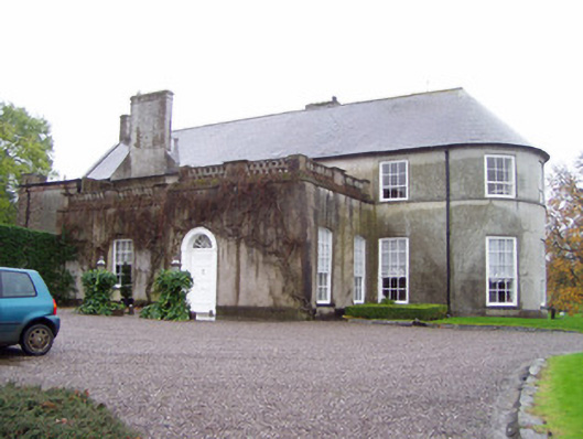 Rockforest Housecountry house · 37 yd
 IndicatedChurch · 298 yd
 Rahan WellHoly well · 1349 yd
 Grave YardGraveyard · 1423 yd
 Carrig Castle (in Ruins)Castle, tower house · 1550 yd
 Mallow Castle RuinRuins · 2.9 mi
 In loving memory of Elvis O'DonoghueMemorial · 3.6 mi
 Mallow River TrailVisitor information · 3.6 mi
 Blackwater WayWalking route · 4.0 mi
 SeefinMountain / peak · 5.2 mi
 Anne's Grove GardensHeritage attraction · 5.9 mi
 Blackwater (Avondhu) WayWalking route · 6.6 mi
Other information
Photo: Credit not shown in the picture search · Rights wording not checked; contact us if this picture should be removed