
What is recorded here
This site is located in the industrial peatlands of Daingean South Bog. It was first recorded in the 2013 Reassessment Peatland Survey as a NE-SW orientated plank togher, exposed in two sightings on the field surface and in the drain face of two production fields (Whitaker 2014). An excavation was carried out in 2014 (licence 14E0311). The site remains undated.
A single cutting was opened, measuring 5x3m, on the location of Sighting B (OF-DAS051b). The excavations revealed the fragmentary remains of the plank togher, which had been truncated by modern drainage. The site seemed to have originally consisted of two parallel laid radially split oak planks (L0.6-1.05m, W0.1-0.13m, D0.04-0.06m) and an associated longitudinal alder roundwood (Diam. 0.06m, L1.36m). The underlying Sphagnum peat was moderately humified with some fine root inclusions.
The site was no longer extant at Sighting A (OF-DAS051a) (Whitaker 2017).
Compiled by: Jane Whitaker/Femke Vleeshouwer
Date of upload: 26 February 2020
The monument record does not grant public access. Check the route and ask the landowner before entering private land.
- What survives
- Recorded monument
Places near here
-RESIZE.jpg) PlatformPlatform, peatland · 297 yd
PlatformPlatform, peatland · 297 yd RoadRoad, class 3 togher · 311 yd
 StructureStructure, peatland · 404 yd
 Saint Clavin's WellSpring · 1041 yd
 Kill Castle (ruins)Castle, tower house · 1455 yd
 CastleCastle, unclassified · 1643 yd
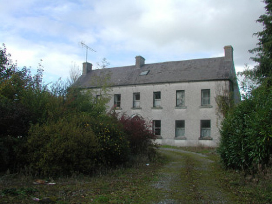 Kilmurry Househouse · 1.1 mi
 Lackan HillMountain / peak · 1.2 mi
 Cruil HillMountain / peak · 1.2 mi
 Graveyard in BallycommonGraveyard · 1.7 mi
 Bracklin WoodWood · 3.1 mi
 Children's WellSpring · 3.3 mi
Other information
Photo: Credit not shown in the picture search · Rights wording not checked; contact us if this picture should be removed