What is recorded here
A circular ring-ditch visible as a crop mark on an aerial photograph together with other features that could indicate a possible field system (DU005-095----) (SMR file; pers. comm. T. Condit). Located on relatively high land south of farmhouse within a gently undulating landscape.
From the National Monuments Service (Archaeological Survey of Ireland) record DU005-094
The monument record does not grant public access. Check the route and ask the landowner before entering private land.
- What survives
- Recorded monument
Places near here
Photo credits
- National Inventory of Architectural Heritage
- Kieran Campbell, Geograph · CC BY-SA 2.0
- Jonjobaker, Wikimedia Commons · CC BY-SA 4.0
- Offdaw, Wikimedia Commons · CC BY-SA 4.0
- GsmithEIDW at English Wikipedia, Wikimedia Commons · Public domain
Field system in SalmonField system · 91 ydEnclosure in SalmonEnclosure · 252 yd Bambers CottageHouse · 738 ydMan O'War HillMountain / peak · 1040 ydMan of WarHouse · 1178 ydFlat cemetery in DarcystownFlat cemetery · 1624 ydBbq AreaPicnic place · 1.1 miBalrothery Heritage CentreMuseum · 1.2 miBalrothery TowerCastle · 1.2 miBlack Hill NurseryWood · 1.2 miWavin LakesNature reserve · 1.3 miArdgillan CastleHeritage attraction · 1.3 mi
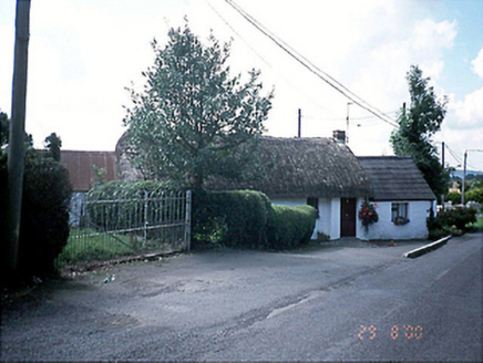 Bambers CottageHouse · 738 ydMan O'War HillMountain / peak · 1040 yd
 Man of WarHouse · 1178 ydFlat cemetery in DarcystownFlat cemetery · 1624 ydBbq AreaPicnic place · 1.1 mi
 Balrothery Heritage CentreMuseum · 1.2 mi
 Balrothery TowerCastle · 1.2 miBlack Hill NurseryWood · 1.2 miWavin LakesNature reserve · 1.3 mi
 Ardgillan CastleHeritage attraction · 1.3 mi
More archaeology and monuments in County Dublin · All of County Dublin
What do you know about this place?