What is recorded here
A central enclosure (diam. c. 25m E-W) surrounded by a series of outer enclosing features and with a field system (DU005-081----) adjoining the outer boundaries visible on Bing Imagery (captured between 13 July 2011 & 27 October 2012) (pers. comm. T. Condit). Located on arable land west of farmhouse that slopes upwards to south. High point in gently undulating landscape. No visible remains.
From the National Monuments Service (Archaeological Survey of Ireland) record DU005-080
The monument record does not grant public access. Check the route and ask the landowner before entering private land.
- What survives
- Recorded monument
Places near here
Photo credits
- National Inventory of Architectural Heritage
- Kieran Campbell, Geograph · CC BY-SA 2.0
- Jonjobaker, Wikimedia Commons · CC BY-SA 4.0
- Offdaw, Wikimedia Commons · CC BY-SA 4.0
- GsmithEIDW at English Wikipedia, Wikimedia Commons · Public domain
Field system in SalmonField system · 69 ydField system in SalmonField system · 179 yd Bambers CottageHouse · 490 ydMan O'War HillMountain / peak · 1286 ydFlat cemetery in DarcystownFlat cemetery · 1375 ydMan of WarHouse · 1405 ydBbq AreaPicnic place · 1736 ydBalrothery Heritage CentreMuseum · 1.0 miBalrothery TowerCastle · 1.0 miBlack Hill NurseryWood · 1.1 miWavin LakesNature reserve · 1.2 miArdgillan CastleHeritage attraction · 1.2 mi
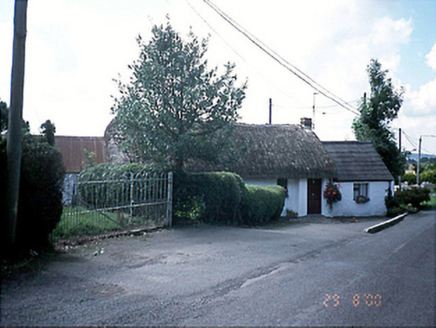 Bambers CottageHouse · 490 ydMan O'War HillMountain / peak · 1286 ydFlat cemetery in DarcystownFlat cemetery · 1375 yd
 Man of WarHouse · 1405 ydBbq AreaPicnic place · 1736 yd
 Balrothery Heritage CentreMuseum · 1.0 mi
 Balrothery TowerCastle · 1.0 miBlack Hill NurseryWood · 1.1 miWavin LakesNature reserve · 1.2 mi
 Ardgillan CastleHeritage attraction · 1.2 mi
More archaeology and monuments in County Dublin · All of County Dublin
What do you know about this place?