DDiscover AloneMapAbout

Ring-ditch in Killadreenan

Ring-ditch
Computer-made picture that does not show Ring-ditch in KilladreenanNot a photo of this monument
Computer-made picture. It does not show this monument. · Report the wrong picture

The monument record does not grant public access. Check the route and ask the landowner before entering private land.

What do you know about this place?Tap to add a comment or ask a question

What you write will be public.

What is recorded here

This report concerns excavations in the townland of Killadreenan during the N11 Newtownmountkennedy–Ballynabarny Road Scheme. Testing by Niall Gregory took place in October 2001 (Excavations 2001, No. 1360, 01E0969) and identified several areas of archaeological potential, apparently of prehistoric date, which were…

Read the whole record
This report concerns excavations in the townland of Killadreenan during the N11 Newtownmountkennedy–Ballynabarny Road Scheme. Testing by Niall Gregory took place in October 2001 (Excavations 2001, No. 1360, 01E0969) and identified several areas of archaeological potential, apparently of prehistoric date, which were excavated and recorded in May and July 2002. The site was bounded by the N11 to the west, a minor road between Newtownmountkennedy and Newcastle to the north, and the valley of the Chapel River to the south. The excavation area lay at the top of the steep and archaeologically featureless north slope of the Chapel River valley, on a flat plateau that measured c. 140m north–south in a construction corridor c. 40m wide, the surface levels of which lay at 70–72m OD after topsoil-stripping. To the north of the flat area the site dropped c. 5m over a distance of c. 80m. Archaeological remains were concentrated in the upper area, with a few scattered features on the northern slope. The remains consisted of a ditch, almost perfectly circular, with an external diameter of c. 10m, an average width of c. 1m and a depth of c. 0.4–0.7m. The ditch enclosure circled a central pit measuring c. 0.97m by 0.77m by c. 0.1m deep and a few slight traces of other possible features. Pottery and flint from the fills of the ditch have been provisionally dated to the Bronze Age, and the group of features is interpreted as a Bronze Age earthen burial monument of ring-ditch or barrow type. The construction corridor was crossed by three east–west-running linear ditches for distances of at least 30m. The latest of these average c. 0.75m wide and c. 0.1m deep and bisected the ring-ditch, truncating the central pit. The second ditch, c. 0.7m wide and c. 0.35–0.7m deep, cut the fill of the ring-ditch in its north-eastern quadrant and was in turn cut by the latest linear ditch at the point where they both crossed the centre-west point of the ring-ditch. The third ditch, c. 0.6m wide and up to 0.7m deep, joined the ring-ditch in its south-eastern quadrant and apparently stopped at the southernmost point of the ring-ditch. A short length of a fourth ditch, probably cutting the ring-ditch, was traceable from a little to the west of this point, running c. 2.5m to the south-west and beyond the edge of the excavation. The third ditch is interpreted as being contemporary with the ring-ditch, and the other ditches, which produced worked flint provisionally dated to the Late Neolithic period and the Early Bronze Age, may be broadly so. A few vestigial and amorphous features immediately east and north-east of the ring-ditch produced a small number of prehistoric pottery fragments. Two small, roughly circular features, c. 0.6–0.8m in diameter and c. 0.05–0.1m deep, lay c. 25m to the south, 4m from each other. These contained charcoal, ash and burnt bone fragments. The western one overlay four, possibly five, stake-holes in the bedrock. Three patches of similar material nearby were thought to have derived from the same source. Four scattered pits were excavated in an area, c. 15–20m long, south-east of the ring-ditch. The largest was circular, with a diameter of c. 2.2m, and was 0.55m deep; it produced a small fragment of prehistoric, probably Bronze Age, pottery and two flint flakes. The second pit measured 1.4m by 1.2m and was 0.18m deep. These two pits contained apparently burnt stones in their fills, suggesting that they may have been associated with cooking operations. The other two pits were considered to have no archaeological significance. In the south-east corner of the upper area, 55–65m south-east of the ring-ditch, lay a small group of features containing burnt material. One of these, measuring c. 0.55m by 0.6m by 0.18m deep, appeared to be a small pit for a fire. The largest was a pit that measured c. 3.7m by 2.4m and was 0.4m deep, containing charcoal, ash and burnt stones, although it was not clear whether these had been burnt in situ. There were two smaller, less well-defined features between these two pits but no finds from this group. On the slope down to the north of the main area of occupation, ten cut features were investigated, two of which may have been post-holes. Of the other seven small pits, three contained burnt material and one contained a flint scraper, probably representing activity on the fringes of the occupied areas. Finds and features in this area suggest human settlement and activity during the Late Neolithic period and the Bronze Age. Aerial photography and investigations carried out under a separate licence suggest that such activity extends into land to the east of this site. Post-excavation work is continuing (Bennett 2004, 535-6).

From the National Monuments Service (Archaeological Survey of Ireland) record WI019-051

Places near here

Photo credits
  • Maker not stated on source page, www.dreamstime.com
  • Maker not stated on source page, fi.pinterest.com
  • Maker not stated on source page, en.wikipedia.org
  • Sarah777, Geograph · Creative Commons Attribution-ShareAlike 2.0
  • National Inventory of Architectural Heritage
  • Maker not stated on source page, uk.pinterest.com
  • Maker not stated on source page, ca.pinterest.com
  • Simon Mortimer / Geograph Ireland, www.geograph.ie
Flat cemetery in KilladreenanFlat cemetery · 136 yd

Explorer Tom Flat cemetery in Killadreenan was nearly sold for a horse during the N11 road construction, which would have been a…

Mapped cemeteryCemetery · 498 yd

Explorer Tom This particular cemetery in County Wicklow decided to give up its ancient stones for Lent this year, replacing them…

Church in Kilmullin (newcastle By., Newcastle Lower Ed)Church · 691 yd

Explorer Tom Church in Kilmullin has strict rules: no running, no talking, and absolutely no asking why a millstone is there. The…

Newcastle HospitalHospital/infirmary · 698 yd

Explorer Tom Newcastle Hospital in Killadreenan is a former sanitarium built by Deane and Son back in the 1870s. It’s got that Queen…

Mount John HouseGate lodge · 995 yd

Explorer Tom Mount John House was nearly sold as a horse because someone misread the listing and thought 'lodge' meant 'stable.'…
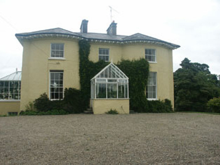
Newcastle HouseHouse · 1004 yd

Explorer Tom Newcastle House is still recovering from that Regency love story that went horribly wrong right next door, probably…

CastleCastle, unclassified · 1355 yd

Explorer Tom Castle in Newcastle Upper got lost looking for the Vikings because they kept taking wrong turns at the medieval borough…

Castle (in ruins)Castle, Anglo-Norman masonry castle · 1470 yd

Explorer Tom Castle in Newcastle Middle claims it’s older than the concept of wearing trousers, which is probably an exaggeration…

Enclosure in Newcastle MiddleEnclosure · 1688 yd

Explorer Tom Enclosure in Newcastle Middle is losing a rivalry with the big castle next door because it’s technically just a rumor…

Newtown GAAGAA ground · 1.1 miNewcastle GAAGAA ground · 1.4 miBullaun stone in Ballyvolan LowerBullaun stone · 1.5 mi

Explorer Tom Bullaun stone in Ballyvolan Lower would post a selfie with the caption 'just chilling upside down' if it had thumbs. It…

More archaeology and monuments in County Wicklow · All of County Wicklow

Add to this placeAdd a picture Add a detailed tip Add a story

Explore the map1,095,414 places to discover

Next place · or swipeFlat cemetery in Killadreenan