What is recorded here
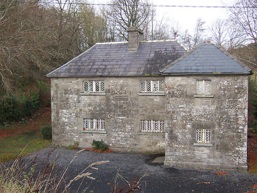
Detached two-bay two storey former Royal Irish Constabulary barracks, built c.1828, with projecting two-storey single-bay towers on square plan to southeast and northwest corners. Later is use as a post office, now in use as a private dwelling. Hipped natural slate roofs (graded) with cast-iron rainwater goods and a cut stone chimneystack to centre. Constructed of coursed rubble limestone with chamfered cut stone plinth to base and flush cut stone quoins to corners. Cut stone plaque to south-facing elevation at first floor level no longer legible. Square-headed window openings with flush cut stone surrounds, horizontal sliding cast-iron diamond pane windows with central mullion and cut stone sills. Cast-iron bars to ground floor window openings. Square-headed doorcase to west face of southeast tower with flush cut stone surround and timber door. Set back from road in own grounds adjacent to main Dublin-Sligo road.
An interesting and solidly-built former Royal Irish Constabulary barracks, which retains its early form and fabric. The cast-iron diamond pane windows are a rare survival. The diagonal towers to the corners, containing the main doorcases, are defensively arranged to ensure that they can be covered from the main body of the building in case of attack. The Royal Irish Constabulary was established during the first decades of the nineteenth century as a response to increased levels of agrarian violence in Ireland. This functional yet picturesque structure dates to this period.
From the Buildings of Ireland (National Inventory of Architectural Heritage) record 15401201
This does not grant access. Most recorded buildings are privately owned; view them only from public ground unless the owner allows entry.
Places near here
Photo credits
- National Inventory of Architectural Heritage
- kevin higgins, Geograph · CC BY-SA 2.0
- Mike Searle, Geograph · CC BY-SA 2.0
- Bridget Neville, Wikimedia Commons · CC BY-SA 4.0
- Rev William Falkiner (Life time: d 1910), Wikimedia Commons · Public domain
- Brian Shaw, Geograph · CC BY-SA 2.0
- Kieran Campbell, Geograph · CC BY-SA 2.0
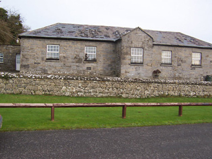 Ballynafid National SchoolSchool · 443 ydOutlinedFairy fort / earthen ringfort · 673 yd
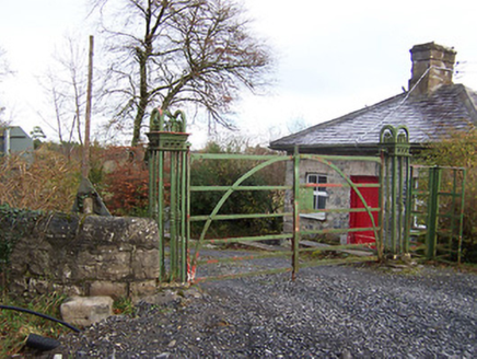 Ardilaun HouseLevel crossing, gates/railings/walls · 735 ydOutlinedFairy fort / earthen ringfort · 736 ydScragh Bog Nature ReserveNature reserve · 1.6 mi
 Church IslandIsland · 2.1 miBridge Memorial (Kenna)Memorial · 2.1 mi
 Carrick CastleCastle · 3.0 mi
 Saint Brigid's WellSpring · 3.5 mi
 Mortimer's CastleArchaeological place · 4.0 mi
 Famine MemorialMemorial · 5.2 mi
 WestmeathVisitor information · 5.5 mi
More historic places in County Westmeath · All of County Westmeath
What do you know about this place?