What is recorded here
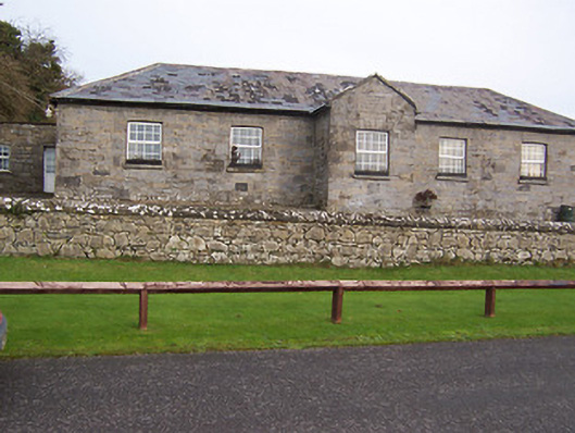
Detached five-bay single-storey former National School, built c.1847, with projecting gable-fronted single-bay single-storey entrance porch to centre of front façade (southwest). Now in use as a community centre. Hipped natural slate roof. Constructed of coursed rubble limestone with square-headed window openings with splayed cut stone surrounds (flush), cut stone sills and replacement windows.' Ballinafid National Schools'. Square-headed doorcases to east face of porch and to east elevation with replacement timber doors. Carved stone plaque to front of entrance porch with inscription: 'These schools erected by a bequest of Mr James Carroll 1847'. Set back from road in own grounds with rubble limestone boundary wall to frontage (southwest). Single-storey extension to northwest corner.
A modestly detailed, mid nineteenth-century school, which retains its early character despite recent alterations. Its form and layout is typical of the many rural schools built throughout Ireland following the establishment of the National Education Board in 1831. It is well-built using good quality local limestone, which helps to integrate this building into the surrounding countryside. Located in a prominent location overlooking the main road, this school contributes positively to the architectural heritage and is an important part of the social history of the local area.
From the Buildings of Ireland (National Inventory of Architectural Heritage) record 15401204
This does not grant access. Most recorded buildings are privately owned; view them only from public ground unless the owner allows entry.
Places near here
Photo credits
- National Inventory of Architectural Heritage
- kevin higgins, Geograph · CC BY-SA 2.0
- Mike Searle, Geograph · CC BY-SA 2.0
- Bridget Neville, Wikimedia Commons · CC BY-SA 4.0
- Rev William Falkiner (Life time: d 1910), Wikimedia Commons · Public domain
- Kieran Campbell, Geograph · CC BY-SA 2.0
OutlinedFairy fort / earthen ringfort · 354 yd Ric barracks443 ydCeremonial enclosure in KnightswoodCeremonial enclosure · 573 ydArdilaun HouseLevel crossing, gates/railings/walls · 804 ydScragh Bog Nature ReserveNature reserve · 1.3 miChurch IslandIsland · 1.9 miBridge Memorial (Kenna)Memorial · 2.3 miCarrickphilbin IslandIslet · 2.3 miCarrick CastleCastle · 3.2 miSaint Brigid's WellSpring · 3.4 miMortimer's CastleArchaeological place · 4.0 miWestmeathVisitor information · 5.6 mi
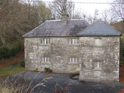 Ric barracks443 ydCeremonial enclosure in KnightswoodCeremonial enclosure · 573 yd
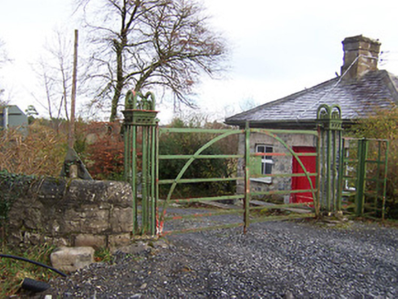 Ardilaun HouseLevel crossing, gates/railings/walls · 804 ydScragh Bog Nature ReserveNature reserve · 1.3 mi
 Church IslandIsland · 1.9 miBridge Memorial (Kenna)Memorial · 2.3 miCarrickphilbin IslandIslet · 2.3 mi
 Carrick CastleCastle · 3.2 mi
 Saint Brigid's WellSpring · 3.4 mi
 Mortimer's CastleArchaeological place · 4.0 mi
 WestmeathVisitor information · 5.6 mi
More historic places in County Westmeath · All of County Westmeath
What do you know about this place?