What is recorded here
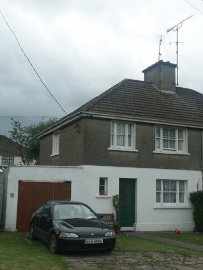
Semi-detached two-bay two-storey house, built 1952. One of a pair forming part of a group of fourteen. Hipped and pitched (shared) concrete tile roof with concrete ridge tiles, rendered (shared) chimney stack, and aluminium rainwater goods on timber eaves. Rendered walls to ground floor on rendered plinth supporting pebbledashed or roughcast walls to first floor. Square-headed window openings in tripartite arrangement with concrete sills, and two-over-two timber sash windows having one-over-one sidelights (one square-headed window opening to ground floor with concrete sill, and fixed-pane timber window). Square-headed door opening with glazed timber panelled door. Set back from street in own grounds with rendered boundary wall having rounded coping, rendered piers having profiled capping, and wrought iron (flat iron) gate [VO].
A pleasant small-scale house built as one of a pair (second in pair not included in survey) forming part of a larger group of fourteen identical units (including 15504008 - 09) established on a site originally donated by Jim Corry (n. d.) representing an element of the continued development of the outskirts or suburbs of Wexford Town in the mid twentieth century. Exhibiting modest architectural aspirations recalling the economic measures put in place during the construction of contemporary local authority-sponsored schemes in the area (see 15507024 - 27), the external expression of the house is nevertheless enlivened by elegant attributes including Wyatt-influenced tripartite openings, and so on. Having been well maintained, the house remains as one of the last in the group to present an early aspect with most of the original fabric surviving in place, thus upholding some of the character or integrity of the collective ensemble in the local landscape.
This does not grant access. Most recorded buildings are privately owned; view them only from public ground unless the owner allows entry.
Places near here
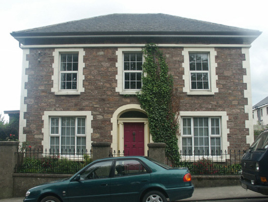 Mount Johnhouse · 48 yd
 Chapel Meadowshouse · 140 yd
 Field boundary in Townparks (st. Peter's Par.) (part of )Field boundary · 227 yd
 St. Margarets WellHoly well · 230 yd
 Michael CollinsMemorial · 343 yd
 Halla KennyMemorial · 482 yd
 The Collins-Grant GalleryGallery · 534 yd
 Siege of Wexfordsiege · 691 yd
 Sack of Wexfordsiege · 692 yd
 Three Sisters River CruisesHeritage attraction · 737 yd
 Castle (in ruinis)Castle, tower house · 1.8 mi
 Site of CastleCastle, unclassified · 1.9 mi
Other information
Photo: National Inventory of Architectural Heritage · Website use allowed for educational or private purposes with source credit