What is recorded here
In a coniferous plantation, on a steep N-facing hillslope. An irregular mound (c. 10m E-W; c. 9m N-S; H c. 0.85m) of heat-shattered stones and charcoal-enriched soil with a central depression was cut by a forest drain c. 1995 (Johnson 1998, 100-101). A buffer zone of 10m around the mound has been left unplanted. Access to the forest was not possible in 2005 due to dense undergrowth.
The above description is derived from 'The Archaeological Inventory of County Cork. Volume 5' (Dublin: Stationery Office, 2009).
Date of upload: 22 December 2009
The monument record does not grant public access. Check the route and ask the landowner before entering private land.
- What survives
- Recorded monument
Places near here
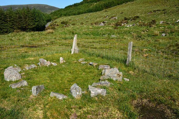 Hut site in KnocknakillaHut site · 361 yd
 Enclosure in KnocknakillaEnclosure · 364 yd
 Standing Stone ? At J WellMemorial · 1594 yd
 Paddy Mulcahey 2009Memorial · 1755 yd
 Church in Glantane EastChurch · 1.1 mi
 Stone pileRuins · 1.4 mi
 MusheramoreMountain / peak · 1.4 mi
 Blackwater (Duhallow) WayWalking route · 2.2 mi
 MusheraMountain / peak · 2.6 mi
 Kilmeedy CastleCastle, tower house · 3.2 mi
 RowanRowan · 3.5 mi
 Birds of DuhallowVisitor information · 3.8 mi