What is recorded here
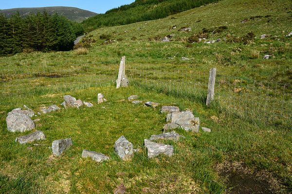
In recently planted forest, on a level terrace of a N-facing mountain slope. The remains of a roughly circular hut site (3.2m E-W; 2.7m N-S) defined by a low wall that consists of stones piled no more than three high. The wall along the S arc comprises slabs (L 0.6m; Wth 0.35m) that appear to have stood upright as revetment against the higher ground. These slabs are now slumped against the upslope. The wall is best preserved NW-S.
The above description is derived from 'The Archaeological Inventory of County Cork. Volume 5' (Dublin: Stationery Office, 2009).
Date of upload: 22 December 2009
The monument record does not grant public access. Check the route and ask the landowner before entering private land.
- What survives
- Recorded monument
Places near here
 Enclosure in KnocknakillaEnclosure · 120 yd
 Burnt mound in KnocknakillaBurnt mound · 646 yd
 Standing Stone ? At J WellMemorial · 1262 yd
 Paddy Mulcahey 2009Memorial · 1394 yd
 Stone pileRuins · 1.2 mi
 MusheramoreMountain / peak · 1.2 mi
 Church in Glantane EastChurch · 1.3 mi
 Blackwater (Duhallow) WayWalking route · 2.0 mi
 MusheraMountain / peak · 2.4 mi
 Kilmeedy CastleCastle, tower house · 3.4 mi
 RowanRowan · 3.7 mi
 Birds of DuhallowVisitor information · 4.0 mi
Other information
Photo: Credit not shown in the picture search · Rights wording not checked; contact us if this picture should be removed