What is recorded here
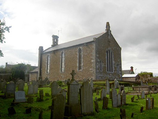
The graveyard in Killenaule (Killenaule parish) is in County Tipperary, Ireland. It occupies the slope to the east and south of the present church, which stands at the highest point of a gentle rise near a motte and bailey 173 metres to the northeast. The square-shaped graveyard measures 46 metres north to south and 48 metres east to west, holding 18th and 19th-century memorials and five reused medieval limestone fragments, including a mullion, two window fragments and two possible door jambs.
On the S side of River Street. The church (TS054-050001-) is at the highest point of a gentle rise with the graveyard occupying the slope of the hill to the E and S of the church and motte and bailey (TS054-050003-) 173m to the NE. The present church is a 19th-century structure built on the site of an earlier 18th-century church. There was clearly a much earlier church on the site as is suggested by an illustration on the Down Survey map of 1655-8. The church was built in the centre of a square-shaped graveyard (int. dims. 46m N-S; 48m E-W) containing 18th and 19th-century memorials. Five medieval architectural fragments, all limestone, including a mullion, two other window fragments and two possible door jambs were found in the graveyard. Each of the fragments has been reused as a grave-marker.
Compiled by: Jean Farrelly
Date of upload: 26 August 2011
The monument record does not grant public access. Check the route and ask the landowner before entering private land.
- What survives
- Recorded monument
Places near here
 Church in Killenaule (killenaule Par.)Church · 1 yd
 Killenaule Heritage Centrechurch/chapel · 12 yd
 Slieveardagh Heritage CentreVisitor information · 16 yd
 Site of CastleCastle, motte and bailey · 193 yd
 RathroeFairy fort / earthen ringfort · 1199 yd
 Enclosure in Knockavadagh,springhill (killenaule Par.)Enclosure · 1438 yd
 CastleCastle, ringwork · 1.0 mi
 Eagle HillMountain / peak · 2.4 mi
 Waterloo HillMountain / peak · 2.5 mi
 Gobban Saer's GraveArchaeological place · 3.3 mi
 Derrynaflan TrailHeritage attraction · 3.3 mi
 Noan WoodWood · 3.6 mi