What is recorded here
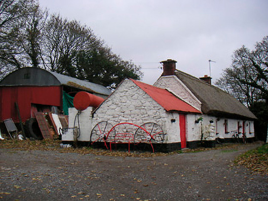
Five-bay single-storey vernacular house, built c.1780, having single-bay single-storey outbuilding abutting to south. Direct entry plan. Pitched thatched roof with red brick chimneystacks to either end (north and south). Constructed of rubble field stone with sections of lime render and whitewash over. Square-headed window openings, irregularly spaced, having cut stone sills and two-over-two pane timber sliding sash windows. Square-headed door opening with glazed timber door. Freestanding cast-iron boot scraper adjacent to main door. Single-bay single-storey whitewashed outbuilding abuts to west having pitched corrugated metal roof and cast-iron rainwater goods. Rubble limestone gate piers to the west.
An appealing small-scale vernacular house of picturesque appearance, which retains its early character, form and fabric. The small window openings and the retention of the timber sash windows and the thatched roof greatly enhances this composition. Houses of this type and nature were once extremely abundant in rural Ireland but it is now very rare to come across an example in such good original condition, making this building an important survival. This modest house has been extended along its length at various stages of its history, which is a common feature of the vernacular architecture of the midlands. This building used readily available materials in its construction, such as local field stone and roofing material probably sourced from the shores of nearby Lough Ree. It is located at a right angle to the road, which is also a common feature of the vernacular architecture of the midlands. The vernacular gate piers complete the setting and add to this unassuming composition. This charming structure is a welcome contributor to the rural setting to the north of Athlone/Ballykerran and remains an important element of the vernacular heritage of Westmeath.
This does not grant access. Most recorded buildings are privately owned; view them only from public ground unless the owner allows entry.
Places near here
 beaconbeacon · 1095 yd
 Dead Man's IslandIslet · 1174 yd
 Carberry IslandIslet · 1194 yd
 OutlinedFairy fort / earthen ringfort · 1424 yd
 Field system in Barry BegField system · 1.0 mi
 RoadRoad, road/trackway · 1.0 mi
 Siege of Athlonesiege · 1.1 mi
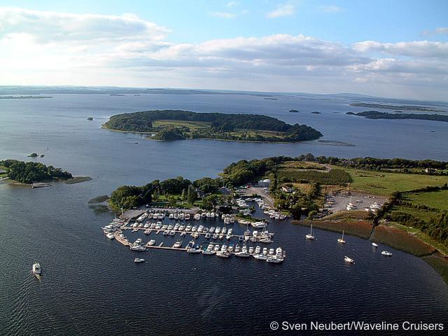 Killinure PointHeadland · 1.5 mi
 Hodson's BayBay · 1.8 mi
 Luan GalleryGallery · 1.8 mi
Other information
Photo: National Inventory of Architectural Heritage · Website use allowed for educational or private purposes with source credit