What is recorded here
One of five ringforts clustered on the west side of the townland, this earthen circle stands atop a knoll in undulating pasture. Its outer bank, overgrown with deciduous trees and briars, rises 1.1 metres above the intervening fosse, enclosing a raised area 38 metres across. The earth and stone construction suggests human hands shaped the landscape long before the trees claimed it back. Breaks in the bank to the northeast, east and south hint at entrances now hidden beneath vegetation, waiting for someone to walk through them again.
In undulating pasture, atop knoll. Circular raised area (38m N-S), incorporating top of knoll and defined by scarp (H 0.8m); intervening fosse; outer dump-constructed earth and stone bank (H 1.1m). Outer bank overgrown with deciduous trees and briars. Break in bank to NE, E and S (UCC). One of a group of five ringforts (CO027-088---; CO027-089---; CO027-092---; C027-094---) at W side of townland.
The above description is derived from the published 'Archaeological Inventory of County Cork. Volume 4: North Cork' (Dublin: Stationery Office, 2000). In certain instances the entries have been revised and updated in the light of recent research.
Date of upload/revision: 14 January 2009
The monument record does not grant public access. Check the route and ask the landowner before entering private land.
- What survives
- Recorded monument
Places near here
 Man-made underground passageMan-made underground passage · 408 yd
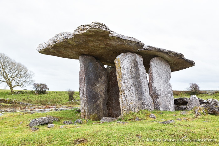 DolmenWedge tomb · 419 yd
 Manning HouseCountry house · 430 yd
 MillMill, unclassified · 589 yd
 Dunmahon Castle (in Ruins)Bawn · 1650 yd
 Glanworth CastleCastle · 1672 yd
 St Dominick's WellSpring · 1.0 mi
 Graveyard in BoherashGraveyard · 1.1 mi
 Blackwater (Avondhu) WayWalking route · 4.3 mi
 Johnson's WoodForest · 4.4 mi
 Priest's WoodForest · 4.6 mi
 Flat cemetery in Ballyenahan NorthFlat cemetery · 4.9 mi