
What is recorded here
A 'mill' indicated on Down Survey (1655-6) barony map on N bank of River Funshion in vicinity of Manning House (14915). However, Grove White (1905-25, vol. 3, 130) noted 'remains of a very long weir and old mill race- the old "Manor Mill" as it was called', opposite on S bank of river, just below Manor House (14906). The 1842 OS 6-inch map does not show any mill features in this locality.
The above description is derived from the published 'Archaeological Inventory of County Cork. Volume 4: North Cork' (Dublin: Stationery Office, 2000). In certain instances the entries have been revised and updated in the light of recent research.
Date of upload/revision: 14 January 2009
The monument record does not grant public access. Check the route and ask the landowner before entering private land.
- What survives
- Recorded monument
Places near here
 Manning HouseCountry house · 184 yd
 IndicatedCountry house · 229 yd
 LabbacalleeWedge tomb · 586 yd
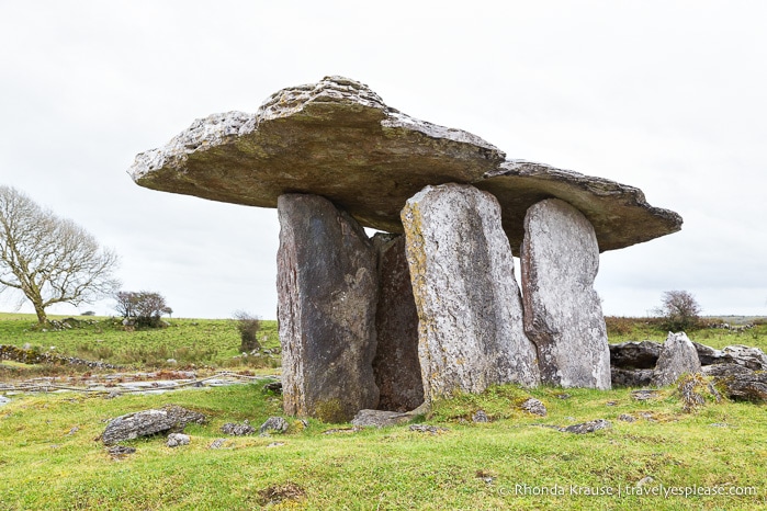 DolmenWedge tomb · 872 yd
 Glanworth CastleCastle · 1.2 mi
 Glanworth Castle (in Ruins)Castle, Anglo-Norman masonry castle · 1.2 mi
 St Dominick's WellSpring · 1.3 mi
 Graveyard in BoherashGraveyard · 1.4 mi
 Blackwater (Avondhu) WayWalking route · 4.3 mi
 Johnson's WoodForest · 4.3 mi
 Priest's WoodForest · 4.5 mi
 Cappagh XViewpoint · 5.0 mi
Other information
Photo: Credit not shown in the picture search · Rights wording not checked; contact us if this picture should be removed