What is recorded here
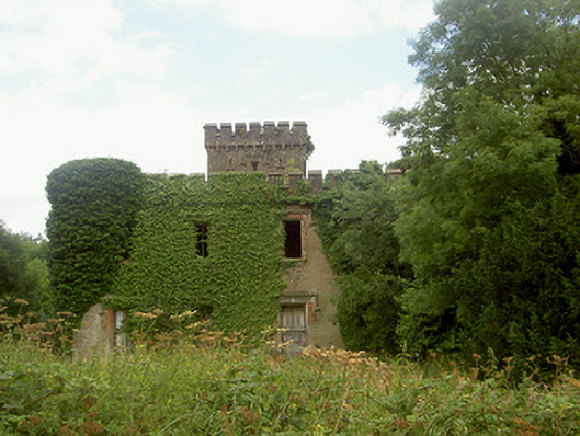
Detached three-bay two-storey house, built 1851, now derelict. Projecting porch to central bay of north (front) elevation, square-profile crenellated tower set back from parapet. Roof hidden behind crenellated parapet, some cast-iron rainwater goods remain. Smooth rendered ruled-and-lined walling, crenellated parapet, random rubble stone tower, stone quoins, some smooth render remaining, crenellated parapet on moulded corbels. Square-headed window openings, tooled limestone sills, red brick surrounds, stone hood-mouldings with label stops, chamfered reveals, limestone lintels to ground floor, windows no longer remain; oculus and arrow loop windows to north elevation of tower. Square-headed door opening to north elevation, set within projecting porch flanked by arrow loop sidelights, chamfered reveals, painted timber panelled door, cast-iron door furniture. Ruined outbuildings to east. House situated within woodland, wheat field to south, derelict gate lodge and cast-iron gates to north-west.
Drumcashel House, built for Richard Macon, retains evidence of its former grandeur in its impressive crenellated parapet and imposing tower. The retention of the gate lodge and the extensive outbuildings, though ruinous, indicate the once important position this demesne had in the area and Drumcashel House makes a positive contribution to the architectural heritage of County Louth.
This does not grant access. Most recorded buildings are privately owned; view them only from public ground unless the owner allows entry.
Places near here
 Drumcashel FortCastle, motte · 121 yd
 Roodstown CastleCastle, tower house · 1301 yd
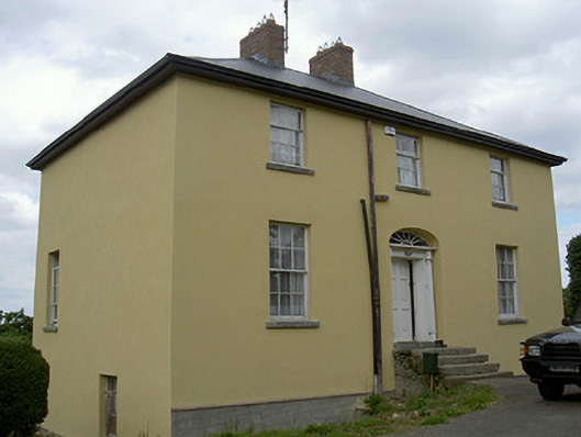 Glebe Houserectory/glebe/vicarage/curate's house · 1412 yd
 Enclosure in RoodstownEnclosure · 1475 yd
 Ecclesiastical enclosure in StabannanEcclesiastical enclosure · 1507 yd
 St. Nicholass ChurchChurch · 1522 yd
 Graveyard in Richardstown (ardee By., Richardstown Par.)Graveyard · 1.1 mi
 Monterey CypressMonterey Cypress · 1.1 mi
 Graveyard in StickillinGraveyard · 1.7 mi
 Rabbit BurrowWood · 2.1 mi
 Drummeenagh HillMountain / peak · 3.8 mi
 Mount OrielMountain / peak · 5.8 mi
Other information
Photo: National Inventory of Architectural Heritage · Website use allowed for educational or private purposes with source credit