What is recorded here
Situated on a long broad ridge just W of Drumcashel House and consisting of a circular flat-topped mound (diam. of summit c. 10.6m, H 6-8m) with a large berm or terrace (Wth 7.7m, H 3.5-4m) at mid-height surrounding it. The berm may be due to landscaping since there are ramp-like features adjoining it at the W and because of its proximity to Drumcashel House. Alternatively, an earlier site such as a raised rath may have been there and the motte has been built on top of this. There is no easy access to the summit and this would lend more weight to the latter interpretation. (Anon. 1923, 203; Tempest 1944, 314)
The above description is derived from both the published 'Archaeological Inventory of County Louth' (Dublin: Stationery Office, 1986) and the 'Archaeological Survey of County Louth' (Dublin: Stationery Office, 1991).
Situated on a long broad ridge just W of Drumcashel House and consisting of a circular flat-topped mound (diam. of summit c. 10.6m, H 6-8m) with a large berm or terrace (Wth 7.7m, H 3.5-4m) at mid-height surrounding it. The berm may be due to landscaping since there are ramp-like features adjoining it at the W and because of its proximity to Drumcashel House. Alternatively, an earlier site such as a raised rath…
From the National Monuments Service (Archaeological Survey of Ireland) record LH014-049
The monument record does not grant public access. Check the route and ask the landowner before entering private land.
- What survives
- Recorded monument
Places near here
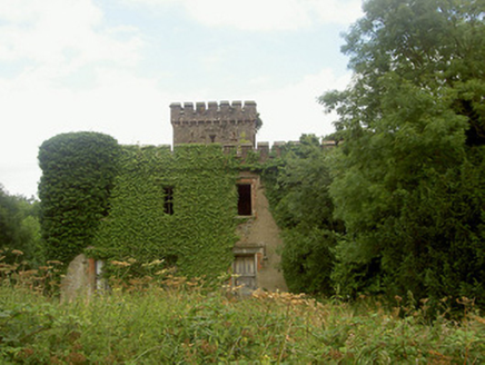 Drumcashel HouseCountry house · 121 yd
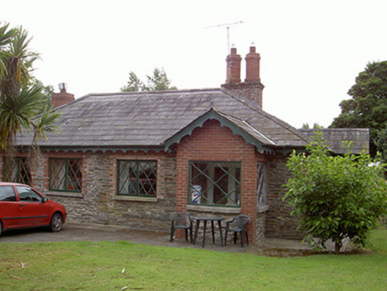 Drumcashel HouseGate lodge · 536 yd
 Roodstown CastleCastle · 1182 yd
 Roodstown CastleCastle, tower house · 1183 yd
 Graveyard in Richardstown (ardee By., Richardstown Par.)Graveyard · 1.1 mi
 Monterey Cypress1.2 mi
 Graveyard in StickillinGraveyard · 1.6 mi
 IndicatedGraveyard · 2.3 mi
 Trinity WellHoly well · 2.6 mi
 European Beech2.8 mi
 Monasterboice Round TowerHeritage attraction · 6.7 mi
 Muiredach's High CrossHeritage attraction · 6.7 mi
Pictures: National Inventory of Architectural Heritage; Kieran Campbell, Wikimedia Commons · CC BY-SA 2.0; Kieran Campbell, Geograph · CC BY-SA 2.0; Kieran Campbell, Geograph · Creative Commons Attribution-ShareAlike 2.0; Vadim Manuylov, Wikimedia Commons · CC BY-SA 3.0; Malene Thyssen, Wikimedia Commons · CC BY-SA 3.0; Colin Park, Geograph · CC BY-SA 2.0; Adriao, Wikimedia Commons · CC BY-SA 4.0
More castles and forts in County Louth · All of County Louth
What do you know about this place?