
What is recorded here
From the National Monuments Service (Archaeological Survey of Ireland) record LH018-014003
The monument record does not grant public access. Check the route and ask the landowner before entering private land.
- What survives
- Recorded monument
Places near here
 Saint Finian's Catholic ChurchChurch/chapel · 72 yd
 CastleCastle, motte · 100 yd
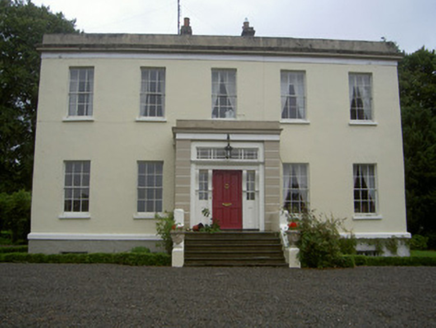 Dromin HouseCountry house · 789 yd
 Monterey Cypress1.1 mi
 Graveyard in Richardstown (ardee By., Richardstown Par.)Graveyard · 1.2 mi
 Richardstown CastleCastle, tower house · 1.2 mi
 Trinity WellHoly well · 2.3 mi
 Graveyard in StickillinGraveyard · 2.8 mi
 European Beech4.1 mi
 The College (in Ruins)College · 4.3 mi
 Monasterboice Round TowerHeritage attraction · 4.6 mi
 Muiredach's High CrossHeritage attraction · 4.6 mi
Pictures: Kieran Campbell, Geograph · CC BY-SA 2.0; Kieran Campbell, Wikimedia Commons · CC BY-SA 2.0; National Inventory of Architectural Heritage; Vadim Manuylov, Wikimedia Commons · CC BY-SA 3.0; Kieran Campbell, Geograph · Creative Commons Attribution-ShareAlike 2.0; Mike Searle, Geograph · CC BY-SA 2.0; Malene Thyssen, Wikimedia Commons · CC BY-SA 3.0; Dasmuy, Wikimedia Commons · CC BY-SA 4.0; Colin Park, Geograph · CC BY-SA 2.0; Adriao, Wikimedia Commons · CC BY-SA 4.0
More archaeology and monuments in County Louth · All of County Louth
What do you know about this place?