What is recorded here
Grave Yard in County Kilkenny holds a medieval church in its southwest angle while a faint earthen bank marks its rectangular edge on a north-facing slope. Ballynaboley tower house watches from two hundred thirty metres northwest, overlooking ground where grave markers have vanished and even the old fence has crumbled into memory. The chambery tower and hidden church suggest a busy local centre, yet time has smoothed the deaths and deeds into quiet soil.
On a N-facing slope with limited views due to rising ground, except to the NE. Ballynaboley tower house (KK024-040----) is located c. 230m to the NW. The medieval church (KK024-042001-) is situated in the SW angle of a graveyard. Indicated on the 1st (1839) ed. OS 6-inch map as a roughly rectangular unenclosed graveyard (dims. c. 56m N-S; c. 70m E-W at the N, narrowing to c. 43m at the S) with a trackway running NW-SE along the W side. The graveyard is not indicated on the 1899-1902 revision of the OS 6-inch map. When described by Carrigan (1905, vol. 3, 485), the ‘surrounding churchyard has now no appearance of graves; the fence that formerly protected it has been thrown down, but can still be traced’.
A rectangular graveyard (dims. c. 55.6m E-W; 27.5m N-S) defined by a barely discernible low earthen bank. There are no upstanding grave-markers.
Compiled by: Jean Farrelly
Date of upload: 27 September 2021
The monument record does not grant public access. Check the route and ask the landowner before entering private land.
- What survives
- Recorded monument
Places near here
 Ballynaboley Church (in ruins)Church · 21 yd
 Ballynaboley Castle (in ruins)Castle, tower house · 262 yd
 The ClahounForest · 482 yd
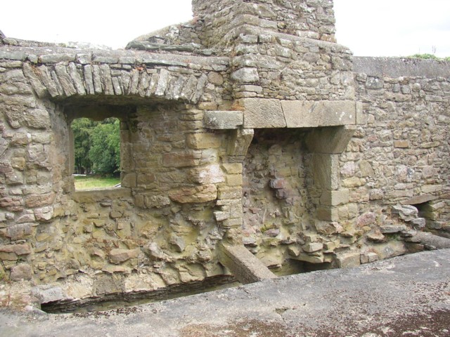 Enclosure in Ballynaboley (gowran By.)Enclosure · 492 yd
 The OrchardForest · 693 yd
 IndicatedEnclosure · 749 yd
 Church in Cloghala (gowran By., Bennettsbridge Ed),dungarvan (gowran By., Bennettsbridge Ed),scart (gowran By., Bramblestown Ed)Church · 1357 yd
 CastleCastle, motte · 1.5 mi
 Tullaherin Church and Round TowerVisitor information · 1.6 mi
 Kilbline GraveyardArchaeological place · 2.3 mi
 Time CapsuleMemorial · 2.6 mi
 St. Mogarra’s WellSpring · 5.1 mi